Tilghman Island (Maryland)

Tilghman Island (Maryland)
Tilghman Island
CDP de los Estados Unidos
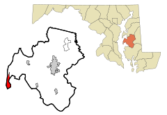
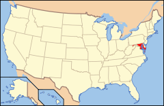
Ubicación en el condado de Talbot en MarylandUbicación de Maryland en EE. UU.
Ubicación en el condado de Talbot en Maryland
Map of USA MD.svg
Ubicación de Maryland en EE. UU.
Entidad CDP
 • País Bandera de los Estados Unidos Estados Unidos
 • Estado Bandera de Maryland Maryland
 • Condado Talbot
Superficie  
 • Total 7,4 km²
 • Tierra 7,0 km²
 • Agua 0,4 km²
Altitud  
 • Media 2 msnm
Población (2010)  
 • Total 784 hab.
 • Densidad 105,95 hab/km²
Huso horario Este: UTC-5
 • en verano UTC-4
Código de área 410

Tilghman Island es un lugar designado por el Censo ubicado en el condado de Talbot en el estado estadounidense de Maryland. En el año 2010 tenía una población de 784 habitantes y una densidad poblacional de 105,95 personas por km².[1]

Contenido

Geografía

Tilghman Island se encuentra ubicado en las coordenadas 38°42′32″N 76°20′6″O / 38.70889, -76.335Coordenadas: 38°42′32″N 76°20′6″O / 38.70889, -76.335.[2]

Demografía

Según la Oficina del Censo en 2000 los ingresos medios por hogar en la localidad eran de $32,763 y los ingresos medios por familia eran $38,304. Los hombres tenían unos ingresos medios de $21,213 frente a los $24,286 para las mujeres. La renta per cápita para la localidad era de $13,851. Alrededor del 17.7% de la población estaba por debajo del umbral de pobreza.[3]

Referencias

  1. «Encuentra un condado» (en inglés). Asociación Nacional de Condados (11 de julio de 2011). Consultado el 11 de julio de 2011.
  2. «American FactFinder» (en inglés). Oficina del Censo de los Estados Unidos. Consultado el 11 de julio de 2011.
  3. «U.S. Gazetteer: Censo de 2010» (en inglés). Oficina del Censo de los Estados Unidos (16 de febrero de 2011). Consultado el 11 de julio de 2011.

Enlaces externos


Wikimedia foundation. 2010.

Игры ⚽ Нужна курсовая?

Mira otros diccionarios:

  • Tilghman Island, Maryland — Infobox Settlement official name = Tilghman Island, Maryland settlement type = CDP nickname = motto = imagesize = image caption = image imagesize = image caption = image mapsize = 250x200px map caption = Location of Tilghman Island, Maryland… …   Wikipedia

  • Tilghman Island — Tilghman Island, MD U.S. Census Designated Place in Maryland Population (2000): 854 Housing Units (2000): 560 Land area (2000): 2.703418 sq. miles (7.001820 sq. km) Water area (2000): 0.142586 sq. miles (0.369295 sq. km) Total area (2000):… …   StarDict's U.S. Gazetteer Places

  • Tilghman Island, MD — U.S. Census Designated Place in Maryland Population (2000): 854 Housing Units (2000): 560 Land area (2000): 2.703418 sq. miles (7.001820 sq. km) Water area (2000): 0.142586 sq. miles (0.369295 sq. km) Total area (2000): 2.846004 sq. miles… …   StarDict's U.S. Gazetteer Places

  • Maryland locations by per capita income — Maryland is the wealthiest state in the United States of America, with a median household income of $69,272 according to the 2010 census.[1] Per capita income was $25,615 in 2000 and personal per capita income was $37,331 in 2003. Maryland… …   Wikipedia

  • Tilghman — People*Benjamin Chew Tilghman, US soldier and inventor *Bill Tilghman, lawman in the Old West period of the American frontier *Kelly Tilghman, a golf announcer *Lloyd Tilghman, Confederate general in the American Civil War *Matthew Tilghman,… …   Wikipedia

  • Maryland Route 329 — Royal Oak Road …   Wikipedia

  • Maryland Route 579 — Bozman Neavitt Road …   Wikipedia

  • Maryland Route 33 — This article is about the current Maryland Route 33. For the former MD 33, see Maryland Route 17. Maryland Route 33 …   Wikipedia

  • Maryland Route 322 — Easton Parkway …   Wikipedia

  • Eastern Shore of Maryland — The Eastern Shore of Maryland is a territorial part of the State of Maryland, USA that lies predominately on the east side of the Chesapeake Bay and consists of nine counties. The origin of term Eastern Shore was derived to distinguish a… …   Wikipedia

Compartir el artículo y extractos

Link directo
Do a right-click on the link above
and select “Copy Link”