Toutle (Washington)

Toutle (Washington)
Toutle
Área no incorporada de los Estados Unidos
Toutle
Toutle
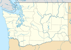
Ubicación en el condado de Cowlitz en el estado de Washington
Map of USA WA.svg
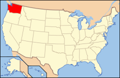
Ubicación de Washington en EE. UU.
46°21′00″N 122°42′00″O / 46.35, -122.7Coordenadas: 46°21′00″N 122°42′00″O / 46.35, -122.7
Entidad Área no incorporada
 • País Bandera de los Estados Unidos Estados Unidos
 • Estado Flag of Washington.svg Washington
 • Condado Cowlitz
Altitud  
 • Media 97 msnm
Huso horario Pacífico: UTC-8
 • en verano UTC-7
Código ZIP 98.649
Código de área 360

Toutle es un área no incorporada ubicada en el condado de Cowlitz en el estado estadounidense de Washington.

Geografía

Toutle se encuentra ubicado en las coordenadas 46°21′0″N 122°42′0″O / 46.35, -122.7Coordenadas: 46°21′0″N 122°42′0″O / 46.35, -122.7.[1]

Referencias

  1. «American FactFinder» (en inglés). Oficina del Censo de los Estados Unidos. Consultado el 11 de julio de 2011.

Enlaces externos


Wikimedia foundation. 2010.

Игры ⚽ Поможем написать реферат

Mira otros diccionarios:

  • Toutle, Washington — Toutle is an unincorporated community in Cowlitz County, Washington, United States. Toutle is located at coord|46|21|N|122|42|W|, approximately ten miles east on SR 504 from exit 49 of I 5. Toutle is not very far from the well known Mount St.… …   Wikipedia

  • Toutle River — Digue de rétention pour sédiments construite après l éruption de 1980 …   Wikipédia en Français

  • Toutle — 46° 18′ 39″ N 122° 55′ 06″ W / 46.31083333, 122.91833333 …   Wikipédia en Français

  • Washington State Route 504 — infobox WA State Route type=WA route=504 sec=655 parent=5 parent type=Interstate length mi=51.76 length ref=cite web|author=Washington State Department of Transportation|url=http://www.wsdot.wa.gov/mapsdata/tdo/PDF and ZIP… …   Wikipedia

  • Toutle River — The Toutle River is a river in southwestern Washington State, in the Pacific Northwest region of the United States. It rises on the flanks of Mount St. Helens and joins the Cowlitz River near Castle Rock.Eruption of Mt. St. HelensThe May 18, 1980 …   Wikipedia

  • Toutle River Sediment Retention Structure — Infobox Dam dam name=Sediment Retention Structure caption=Aerial photograph looking upriver with Mt. St. Helens in the background official name=Sediment Retention Structure crosses= reservoir= locale=North Fork Toutle River maint=US Army Corps of …   Wikipedia

  • Washington Interscholastic Activities Association — The Washington Interscholastic Activities Association is the governing body of high school athletics and activities in the state of Washington. WIAA sanctioned activitiesThe WIAA oversees the following activities:AthleticsCascadeNorthwest 1Bouth… …   Wikipedia

  • Barrage de rétention des sédiments de la Toutle — Toutle River Sediment Retention Structure Géographie Pays …   Wikipédia en Français

  • North Fork Toutle River — This dam was built on the North Fork in response to the Mount St. Helens eruption The North Fork Toutle River is a tributary of the Toutle River in the southwestern Washington in the United States. The river has its headwaters near Spirit Lake,… …   Wikipedia

  • Cowlitz County, Washington — Location in the state of Washington …   Wikipedia

Compartir el artículo y extractos

Link directo
Do a right-click on the link above
and select “Copy Link”