U.S. Route 119

U.S. Route 119
US 119.svg
U.S. Route 119
Bandera de los Estados Unidos Estados Unidos
US 119 map.png
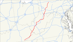
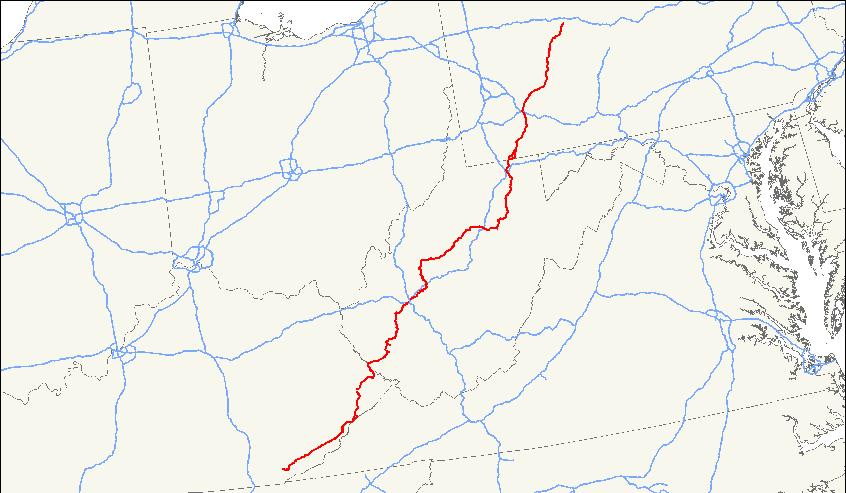
Identificador  119 
Inauguración 1926[1]
Longitud 585 millas[1]
Orientación Sur a Norte
 • Sur  US 25E en Pineville, KY
 • Norte  US 219 en el municipio de Sandy, PA
Cruces

 US 421 cerca de Harlan, KY
 US 23  US 460  KY 80 en Pikeville, KY
 I 64  I 77 en Charleston, WV
 US 33 desde Spencer a Buckhanon, WV
 I 79 cerca de Weston, WV
 US 50 en Grafton, WV
 I 68 a Morgantown, WV
 US 40 en Uniontown, PA
 I 70  I 76 Pennsylvania Turnpike logo.svg PATP en New Stanton, PA
 US 30 en Greensburg, PA
 US 22 cerca de Blairsville, PA

 US 422 en Indiana, PA

U.S. Route 119, comúnmente abreviada como US 119, es un ramal de la US 19. Es una carretera de sentido norte–sur, además es una de las primeras carreteras federales en ser construidas en 1926. Es a menudo llamada como Corredor G al este de la US 23 y KY 80 en Kentucky a la Interestatal 64 en Charleston, Virginia Occidental.

Referencias

  1. a b US Highways from US 1 to US 830 Robert V. Droz

Wikimedia foundation. 2010.

Игры ⚽ Нужна курсовая?

Mira otros diccionarios:

  • Ohio State Route 119 — State Route 119 Route information Maintained by ODOT Length: 42.07 mi[1 …   Wikipedia

  • U.S. Route 119 — Infobox U.S. Route article route=119 length mi=585 length ref= [http://www.us highways.com/us1830.htm US Highways from US 1 to US 830] Robert V. Droz] yrcom=1926 direction a=South from=Jct|state=KY|US|25E in Pineville, KY… …   Wikipedia

  • London Buses route 119 — infobox London Bus number=119 operator=Metrobus garage=Orpington Croydon vehicle=Scania OmniDekka 10.6m pvr=Monday to Saturday: 16 Sunday: 9 start=Croydon Airport via=Croydon West Wickham Hayes end=Bromley North level=24 hour service length=11… …   Wikipedia

  • Utah State Route 119 — Infobox road state=UT type=SR route=119 section=117 maint=UDOT length mi=8.753 length round=3 length ref=Utah Department of Transportation, [http://www.udot.utah.gov/main/f?p=100:pg:2814615533739116:::1:T,V:814, Highway Reference Information] :… …   Wikipedia

  • New Hampshire Route 119 — Route information Maintained by NHDOT Length: 39.91 mi …   Wikipedia

  • Georgia State Route 119 — infobox road state=GA type=GA route=119 length mi=81.3 length round=1 length ref= [cite map|url=http://maps.google.com/maps?f=d saddr=S+Costal+Hwy%2FUS 17+%4031.743940,+ 81.440033 daddr=GA 119+%4031.798280,+ 81.645030+to:GA 119+%4031.852573,+… …   Wikipedia

  • California State Route 119 — Infobox road state=CA type=SR route=119 section=419 maint=Caltrans length mi=31 length round=0 length ref= [ [http://www.dot.ca.gov/hq/structur/strmaint/brlog2.htm January 1, 2006 California Log of Bridges on State Highways] ] direction a=West… …   Wikipedia

  • Alabama State Route 119 — Infobox road state=AL type=AL route=119 length mi=38 length ref= [ [http://colepages.com/routes125.html Highway Route Info Routes 1 25 ] ] length round= established=1953 direction a=South direction b=North starting terminus= junction= ending… …   Wikipedia

  • Virginia State Route 119 — Infobox road state=VA type= route=119 alternate name=Calvary Road length mi=3.08 length ref=PDFlink| [http://www.virginiadot.org/info/resources/AADT 041 Halifax 2005.pdf 2005 Virginia Department of Transportation Jurisdiction Report Daily Traffic …   Wikipedia

  • Malaysia Federal Route 119 — Federal Route 119 Jalan Simpang Kenyum Major junctions Northwest end: Ulu Melaka   …   Wikipedia

  • Washington State Route 119 — infobox WA State Route type=WA route=119 sec=223 parent=101 parent type=US length mi=10.93 length ref=cite web|author=Washington State Department of Transportation|url=http://www.wsdot.wa.gov/mapsdata/tdo/PDF and ZIP… …   Wikipedia

Compartir el artículo y extractos

Link directo
Do a right-click on the link above
and select “Copy Link”