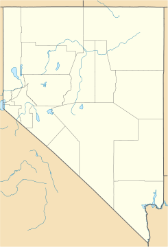
Unionville, Nevada — Unionville is a small hamlet in Pershing County, Nevada, with the most recent population estimate being approximately 20 people. The town s best years were during the 1870s, when it was an active mining and prospecting town serving the… … Wikipedia
Unionville — is the name of some places in North America:Canada*Unionville, Ontario **Unionville GO Station, a station in the GO Transit network located in the communityUnited States*Unionville, Connecticut *Unionville, Georgia *Unionville, Indiana… … Wikipedia
Unionville — ist die Bezeichnung mehrerer Orte in Kanada: Unionville (Ontario) in den USA: Unionville (Connecticut) Unionville (Georgia) Unionville (Indiana) Unionville (Iowa) Unionville (Louisiana) Unionville (Michigan) Unionville (Missouri) Unionville… … Deutsch Wikipedia
Nevada Historical Markers — identify significant places of interest in Nevada s history. The Historic Marker Program was initiated by the Nevada State Legislature in 1967 to bring the state s heritage to the public s attention with on site markers. Because of budget cuts… … Wikipedia
Nevada, Missouri — City Location of Nevada, Miss … Wikipedia
Nevada State Route 400 — State Route 400 Unionville Road Route information Maintained by NDOT Length … Wikipedia
Mill City, Nevada — Mill City is an unincorporated community in Pershing County, Nevada, United States. The ZIP Code of Mill City is 89418. Mill City was established to process the ore from nearby mines at a location with water from the Humboldt River and railroad… … Wikipedia
Lovelock, Nevada — incorporated city A welcoming town … Wikipedia
Dun Glen, Nevada — Dun Glen (later Chafey) is a ghost town in Pershing County, Nevada, United States, north of the present community of Mill City. Found in 1862, it was a silver mining community founded at a site then within Humboldt County. Contents 1 Dun Glenn 2… … Wikipedia
List of ghost towns in Nevada — This is an incomplete list of ghost towns in Nevada, listed by town name, and also by county. Most ghost towns in Nevada were mining towns abandoned when the mines closed.Listed by town name*Aurora *Belleville *Belmont *Beowawe *Berlin *Blair… … Wikipedia
 Unionville
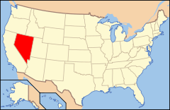
 Estados Unidos
 Nevada
 Portal:Nevada. Contenido relacionado con Nevada.
 Wikimedia Commons alberga contenido multimedia sobre Unionville (Nevada). Commons
