Voorheesville

Voorheesville
Voorheesville
Villa de los Estados Unidos
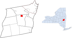
AlbanyCounty Voorheesville with NY.svg
Ubicación en el condado de Albany y en el estado de Nueva York
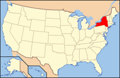
Map of USA NY.svg
Ubicación de Nueva York en EE. UU.
Entidad Villa
 • País Bandera de los Estados Unidos Estados Unidos
 • Estado Flag of New York.svg Nueva York
 • Condado Albany
Superficie  
 • Total 5,5 km²
 • Tierra 5,5 km²
 • Agua (0%) 0 km²
Altitud  
 • Media 103 msnm
Población (2000)  
 • Total 2.705 hab.
 • Densidad 489 hab/km²
Huso horario Este: UTC-5
 • en verano UTC-4
Código ZIP 12186
Código de área 518

Voorheesville es una villa ubicado en el condado de Albany en el estado estadounidense de Nueva York. En el año 2000 tenía una población de 2,705 habitantes y una densidad poblacional de 489 personas por km².[1]

Geografía

Voorheesville se encuentra ubicada en las coordenadas 42°38′59″N 73°55′45″O / 42.64972, -73.92917.[2]

Referencias

  1. «U.S. Gazetteer: Censo de 2010» (en inglés). Oficina del Censo de los Estados Unidos (16 de febrero de 2011). Consultado el 11 de julio de 2011.
  2. «American FactFinder» (en inglés). Oficina del Censo de los Estados Unidos. Consultado el 11 de julio de 2011.

Enlaces externos


Wikimedia foundation. 2010.

Игры ⚽ Поможем написать реферат

Mira otros diccionarios:

  • Voorheesville — Voorheesville, NY U.S. village in New York Population (2000): 2705 Housing Units (2000): 1064 Land area (2000): 2.133972 sq. miles (5.526963 sq. km) Water area (2000): 0.000000 sq. miles (0.000000 sq. km) Total area (2000): 2.133972 sq. miles… …   StarDict's U.S. Gazetteer Places

  • Voorheesville, NY — U.S. village in New York Population (2000): 2705 Housing Units (2000): 1064 Land area (2000): 2.133972 sq. miles (5.526963 sq. km) Water area (2000): 0.000000 sq. miles (0.000000 sq. km) Total area (2000): 2.133972 sq. miles (5.526963 sq. km)… …   StarDict's U.S. Gazetteer Places

  • Voorheesville — Original name in latin Voorheesville Name in other language State code US Continent/City America/New York longitude 42.65397 latitude 73.92874 altitude 101 Population 2789 Date 2011 05 14 …   Cities with a population over 1000 database

  • Voorheesville, New York — Infobox Settlement official name = Voorheesville, New York settlement type = Village nickname = motto = imagesize = image caption = image |pushpin pushpin label position = pushpin map caption =Location within the state of New York pushpin mapsize …   Wikipedia

  • 12186 — Voorheesville, Ny (Miscellaneous » ZIP Codes) …   Abbreviations dictionary

  • New York State Route 156 — NYS Route 156 Route information Maintained by NYSDOT Length: 16.37 mi[ …   Wikipedia

  • New York State Route 85A — NYS Route 85A Route information Maintained by NYSDOT Length: 5.54 mi[ …   Wikipedia

  • Albany County, New York — For the city of Albany, New York, see Albany, New York. Coordinates: 42°39′35″N 73°46′53″W / 42.65972°N 73.78139°W / …   Wikipedia

  • New York State Route 155 — NYS Route 155 Route information Maintained by NYSDOT, Albany County and the city of Watervliet Length: 16.85 mi …   Wikipedia

  • New Salem, New York — Coordinates: 42°37′22″N 73°58′04″W / 42.62278°N 73.96778°W / 42.62278; 73.96778 …   Wikipedia

Compartir el artículo y extractos

Link directo
Do a right-click on the link above
and select “Copy Link”