Waterville (Vermont)

Waterville (Vermont)
Waterville
Pueblo de los Estados Unidos
Wvlhal01.JPGAyuntamiento de Waterville
Waterville
Waterville
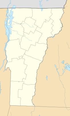
Ubicación en el condado de Lamoille en Vermont
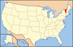
Ubicación de Vermont en EE. UU.
44°42′52″N 72°44′56″O / 44.71444, -72.74889Coordenadas: 44°42′52″N 72°44′56″O / 44.71444, -72.74889
Entidad Pueblo
 • País Bandera de los Estados Unidos Estados Unidos
 • Estado Flag of Vermont.svg Vermont
 • Condado Lamoille
Superficie  
 • Total 42,5 km²
 • Tierra 42,5 km²
 • Agua (0%) 0 km²
Altitud  
 • Media 299 msnm
Población (2010)  
 • Total 673 hab.
 • Densidad 15,84 hab/km²
Huso horario Este: UTC-5
 • en verano UTC-4
Código ZIP 05492
Código de área 802

Waterville es un pueblo ubicado en el condado de Lamoille en el estado estadounidense de Vermont. En el año 2010 tenía una población de 673 habitantes y una densidad poblacional de 15,84 personas por km².[1]

Contenido

Geografía

Waterville se encuentra ubicado en las coordenadas 44°42′52″N 72°44′56″O / 44.71444, -72.74889Coordenadas: 44°42′52″N 72°44′56″O / 44.71444, -72.74889.[2]

Demografía

Según la Oficina del Censo en 2000 los ingresos medios por hogar en la localidad eran de $39,453 y los ingresos medios por familia eran $42,857. Los hombres tenían unos ingresos medios de $34,250 frente a los $22,917 para las mujeres. La renta per cápita para la localidad era de $18,081. Alrededor del 10.7% de la población estaba por debajo del umbral de pobreza.[3]

Referencias

  1. «Encuentra un condado» (en inglés). Asociación Nacional de Condados (11 de julio de 2011). Consultado el 11 de julio de 2011.
  2. «U.S. Gazetteer: Censo de 2010» (en inglés). Oficina del Censo de los Estados Unidos (16 de febrero de 2011). Consultado el 11 de julio de 2011.
  3. «American FactFinder» (en inglés). Oficina del Censo de los Estados Unidos. Consultado el 11 de julio de 2011.

Enlaces externos


Wikimedia foundation. 2010.

Игры ⚽ Нужно решить контрольную?

Mira otros diccionarios:

  • Waterville, Vermont — Infobox Settlement official name = Waterville, Vermont settlement type = Town nickname = motto = imagesize = 250px image caption = Waterville town hall image mapsize = 250px map caption = Waterville, Vermont mapsize1 = map caption1 = subdivision… …   Wikipedia

  • Waterville — is the name of several places.In the United States: * Waterville, Iowa * Waterville, Kansas * Waterville, Maine * Waterville, Minnesota * Waterville, New York * Waterville, Ohio * Waterville, Pennsylvania * Waterville, Vermont * Waterville,… …   Wikipedia

  • Waterville — ist die Bezeichnung mehrerer Orte in Irland: Waterville (County Kerry) in Kanada: Waterville (Québec) in den USA: Waterville (Iowa) Waterville (Kansas) Waterville (Maine) Waterville (Minnesota) Waterville (New York) Waterville (Ohio) Waterville… …   Deutsch Wikipedia

  • Vermont locations by per capita income — Vermont has the twenty fifth highest per capita income in the United States of America, at $20,625 (2000). Its personal per capita income is $30,740 (2003).Vermont counties ranked by per capita incomeThere are fourteen counties located in Vermont …   Wikipedia

  • Waterville and Wiscasset Railroad — Streckennetz der WW F magenta = Strecke 2006 in Betrieb rot = Strecke stillgelegt dünn rot = nie eröffnet Die Wiscasset, Waterville and Farmington Railway (WW F) ist eine ehemalige Eisenbahngesellschaft in Maine (Vereinigte Staaten). Sie bestand… …   Deutsch Wikipedia

  • National Register of Historic Places listings in Lamoille County, Vermont — Location of Lamoille County in Vermont This is a list of the National Register of Historic Places listings in Lamoille County, Vermont. This is intended to be a complete list of the properties and districts on the National Register of Historic… …   Wikipedia

  • Historical U.S. Census totals for Lamoille County, Vermont — This article shows U.S. Census totals for Lamoille County, Vermont, broken down by municipality, from 1900 to 2000.Like most areas of New England, Lamoille County is (and has been at all times since well before the 20th century) entirely divided… …   Wikipedia

  • Wiscasset, Waterville and Farmington Railroad — Streckennetz der WW F magenta = Strecke 2006 in Betrieb rot = Strecke stillgelegt dünn rot = nie eröffnet Die Wiscasset, Waterville and Farmington Railway (WW F) ist eine ehemalige Eisenbahngesellschaft in Maine (Vereinigte Staaten). Sie bestand… …   Deutsch Wikipedia

  • Wiscasset, Waterville and Farmington Railway — Streckennetz der WW F magenta = Strecke 2006 in Betrieb rot = Strecke stillgelegt dünn rot = nie eröffnet Die Wiscasset, Waterville and Farmington Railway (WW F) ist eine ehemalige Eisenbahngesellschaft in Maine (Vereinigte Staaten). Sie bestand… …   Deutsch Wikipedia

  • Morrisville, Vermont —   Village   Downtown Morrisville, looking east along Main Street …   Wikipedia

Compartir el artículo y extractos

Link directo
Do a right-click on the link above
and select “Copy Link”