Weleetka (Oklahoma)

Weleetka (Oklahoma)
Weleetka
Pueblo de los Estados Unidos
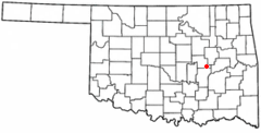
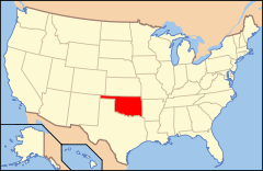
Ubicación en el condado de Okfuskee en OklahomaUbicación de Oklahoma en EE. UU.
Ubicación en el condado de Okfuskee en Oklahoma
Map of USA OK.svg
Ubicación de Oklahoma en EE. UU.
Entidad Pueblo
 • País Bandera de los Estados Unidos Estados Unidos
 • Estado Flag of Oklahoma.svg Oklahoma
 • Condado Okfuskee
Superficie  
 • Total 1,8 km²
 • Tierra 1,8 km²
 • Agua (0%) 0 km²
Altitud  
 • Media 221 msnm
Población (2010)  
 • Total 998 hab.
 • Densidad 554,44 hab/km²
Huso horario Centro: UTC-6
 • en verano UTC-5
Código ZIP 74880
Código de área 405

Weleetka es un pueblo ubicado en el condado de Okfuskee en el estado estadounidense de Oklahoma. En el año 2010 tenía una población de 998 habitantes y una densidad poblacional de 554,44 personas por km².[1]

Contenido

Geografía

Weleetka se encuentra ubicado en las coordenadas 35°20′44″N 96°8′5″O / 35.34556, -96.13472 (35.345626, -96.134592).[2]

Demografía

Según la Oficina del Censo en 2000 los ingresos medios por hogar en la localidad eran de $19,141 y los ingresos medios por familia eran $26,917. Los hombres tenían unos ingresos medios de $23,542 frente a los $15,227 para las mujeres. La renta per cápita para la localidad era de $12,103. Alrededor del 27.9% de la población estaban por debajo del umbral de pobreza.[3]

Referencias

  1. «Encuentra un condado» (en inglés). Asociación Nacional de Condados (11 de julio de 2011). Consultado el 11 de julio de 2011.
  2. «U.S. Gazetteer: Censo de 2010» (en inglés). Oficina del Censo de los Estados Unidos (16 de febrero de 2011). Consultado el 11 de julio de 2011.
  3. «American FactFinder» (en inglés). Oficina del Censo de los Estados Unidos. Consultado el 11 de julio de 2011.

Enlaces externos


Wikimedia foundation. 2010.

Игры ⚽ Нужна курсовая?

Mira otros diccionarios:

  • Weleetka, Oklahoma — Infobox Settlement official name = Weleetka, Oklahoma settlement type = Town nickname = We Town motto = imagesize = image caption = image mapsize = 250px map caption = Location of Weleetka, Oklahoma mapsize1 = map caption1 = subdivision type =… …   Wikipedia

  • Weleetka — 35° 20′ 44″ N 96° 08′ 05″ W / 35.345556, 96.134722 …   Wikipédia en Français

  • Weleetka — Weleetka, OK U.S. town in Oklahoma Population (2000): 1014 Housing Units (2000): 450 Land area (2000): 0.692763 sq. miles (1.794248 sq. km) Water area (2000): 0.000000 sq. miles (0.000000 sq. km) Total area (2000): 0.692763 sq. miles (1.794248 sq …   StarDict's U.S. Gazetteer Places

  • Weleetka, OK — U.S. town in Oklahoma Population (2000): 1014 Housing Units (2000): 450 Land area (2000): 0.692763 sq. miles (1.794248 sq. km) Water area (2000): 0.000000 sq. miles (0.000000 sq. km) Total area (2000): 0.692763 sq. miles (1.794248 sq. km) FIPS… …   StarDict's U.S. Gazetteer Places

  • Oklahoma locations by per capita income — Oklahoma is the 37th richest state in the United States of America, with a per capita income of $32,210 in 2006 and the third fastest growing per capita income in the nation.[1] Oklahoma also has one of the lowest costs of living in the nation,… …   Wikipedia

  • Oklahoma State Highway 84 — State Highway 84 Route information Maintained by ODOT Length: 10 mi (20 km) …   Wikipedia

  • List of high schools in Oklahoma — This is a list of high schools in the state of Oklahoma.Adair County*Cave Springs Public Schools **Cave Springs High School, Bunch *Stilwell High School, Stilwell *Watts High School, Watts *Westville High School, WestvilleAlfalfa County*Aline… …   Wikipedia

  • List of Oklahoma school districts by county — This list only includes the public school districts in the state of Oklahoma, of which there are approximately 471 as of Fall 2003. The trend is toward a consolidation every year or two, which is slowly lessening this number.*Adair County,… …   Wikipedia

  • Okfuskee County, Oklahoma — Location in the state of Oklahoma …   Wikipedia

  • National Register of Historic Places listings in Okfuskee County, Oklahoma — Location of Okfuskee County in Oklahoma This is a list of the National Register of Historic Places listings in Okfuskee County, Oklahoma. This is intended to be a complete list of the properties and districts on the National Register of Historic… …   Wikipedia

Compartir el artículo y extractos

Link directo
Do a right-click on the link above
and select “Copy Link”