West Fairlee (Vermont)

West Fairlee (Vermont)
West Fairlee
Pueblo de los Estados Unidos
West Fairlee
West Fairlee
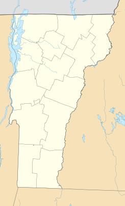
Ubicación en el condado de Orange en Vermont
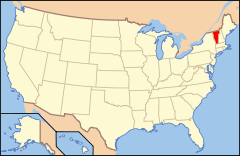
Ubicación de Vermont en EE. UU.
43°55′20″N 72°14′4″O / 43.92222, -72.23444Coordenadas: 43°55′20″N 72°14′4″O / 43.92222, -72.23444
Entidad Pueblo
 • País Bandera de los Estados Unidos Estados Unidos
 • Estado Flag of Vermont.svg Vermont
 • Condado Orange
Superficie  
 • Total 59,1 km²
 • Tierra 58,5 km²
 • Agua (0,96%) 0,6 km²
Altitud  
 • Media 223 msnm
Población (2010)  
 • Total 652 hab.
 • Densidad 11,03 hab/km²
Huso horario Este: UTC-5
 • en verano UTC-4
Código ZIP 05083
Código de área 802
Sitio web oficial

West Fairlee es un pueblo ubicado en el condado de Orange en el estado estadounidense de Vermont. En el año 2010 tenía una población de 652 habitantes y una densidad poblacional de 11,03 personas por km².[1]

Contenido

Geografía

West Fairlee se encuentra ubicado en las coordenadas 43°55′20″N 72°14′4″O / 43.92222, -72.23444Coordenadas: 43°55′20″N 72°14′4″O / 43.92222, -72.23444.[2]

Demografía

Según la Oficina del Censo en 2000 los ingresos medios por hogar en la localidad eran de $40,667 y los ingresos medios por familia eran $42,500. Los hombres tenían unos ingresos medios de $27,200 frente a los $22,788 para las mujeres. La renta per cápita para la localidad era de $18,011. Alrededor del 10.7% de la población estaba por debajo del umbral de pobreza.[3]

Referencias

  1. «Encuentra un condado» (en inglés). Asociación Nacional de Condados (11 de julio de 2011). Consultado el 11 de julio de 2011.
  2. «U.S. Gazetteer: Censo de 2010» (en inglés). Oficina del Censo de los Estados Unidos (16 de febrero de 2011). Consultado el 11 de julio de 2011.
  3. «American FactFinder» (en inglés). Oficina del Censo de los Estados Unidos. Consultado el 11 de julio de 2011.

Enlaces externos


Wikimedia foundation. 2010.

Игры ⚽ Поможем решить контрольную работу

Mira otros diccionarios:

  • West Fairlee, Vermont — Infobox Settlement official name = Pagename other name = native name = nickname = settlement type = Town motto = imagesize = image caption = flag size = image seal size = image shield = shield size = image blank emblem = blank emblem size =… …   Wikipedia

  • Fairlee, Vermont — Infobox Settlement official name = Pagename other name = native name = nickname = settlement type = Town motto = imagesize = image caption = flag size = image seal size = image shield = shield size = image blank emblem = blank emblem size =… …   Wikipedia

  • Vermont locations by per capita income — Vermont has the twenty fifth highest per capita income in the United States of America, at $20,625 (2000). Its personal per capita income is $30,740 (2003).Vermont counties ranked by per capita incomeThere are fourteen counties located in Vermont …   Wikipedia

  • Orange-2 Vermont Representative District, 2002–2012 — The Orange 2 Representative District is a one member state Representative district in the U.S. state of Vermont. It is one the 108 one or two member districts into which the state was divided by the redistricting and reapportionment plan… …   Wikipedia

  • Vermont Route 25 — Route information Maintained by VTrans Length: 17.739 mi …   Wikipedia

  • National Register of Historic Places listings in Orange County, Vermont — Location of Orange County in Vermont This is a list of the National Register of Historic Places listings in Orange County, Vermont. This is intended to be a complete list of the properties and districts on the National Register of Historic Places …   Wikipedia

  • Historical U.S. Census totals for Orange County, Vermont — This article shows U.S. Census totals for Orange County, Vermont, broken down by municipality, from 1900 to 2000.Like most areas of New England, Orange County is (and has been at all times since well before the 20th century) entirely divided into …   Wikipedia

  • Orange County, Vermont — For other uses, see Orange County (disambiguation). Orange County, Vermont Location in the state of Vermont …   Wikipedia

  • Caledonia Vermont Senate District, 2002–2012 — The Caledonia Senate District is one of 13 Vermont Senate districts included in the redistricting and reapportionment plan developed by the Vermont General Assembly following the 2000 U.S. Census. The plan applies to legislatures elected in 2002 …   Wikipedia

  • Randolph, Vermont —   Town   Downtown Randolph …   Wikipedia

Compartir el artículo y extractos

Link directo
Do a right-click on the link above
and select “Copy Link”