Whitesburg (Georgia)

Whitesburg (Georgia)
Whitesburg
Pueblo de los Estados Unidos
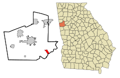
Carroll County Georgia Incorporated and Unincorporated areas Whitesburg Highlighted.svg
Ubicación en el condado de Carroll en el estado de Georgia
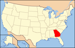
Map of USA GA.svg
Entidad Pueblo
 • País Bandera de los Estados Unidos Estados Unidos
 • Estado Bandera de Georgia (Estados Unidos) Georgia
 • Condado Carroll
Superficie  
 • Total 7,3 km²
 • Tierra 7,2 km²
 • Agua 0,1 km²
Altitud  
 • Media 258 msnm
Población (2000)  
 • Total 596 hab.
 • Densidad 81.6 hab/km²
Huso horario Este: UTC-5
 • en verano UTC-4
Código ZIP 30185
Código de área 770

Whitesburg es un pueblo ubicado en el condado de Carroll en el estado estadounidense de Georgia. En el censo de 2000, su población era de 596.

Demografía

En el 2000[1] la renta per cápita promedia del hogar era de $26,750, y el ingreso promedio para una familia era de $29,167. El ingreso per cápita para la localidad era de $14,189. Los hombres tenían un ingreso per cápita de $30,417 contra $22,353 para las mujeres.

Geografía

Whitesburg se encuentra ubicado en las coordenadas 33°29′36″N 84°54′49″O / 33.49333, -84.91361 (33.493434, -84.913492)[2] .

Según la Oficina del Censo, la localidad tiene un área total de 7,3 km² (2,8 mi²), de la cual 7,2 km² (2,8 mi²) es tierra y 0,1 km² (0 mi²) (0.00%) es agua.[2]

Referencias

  1. «American FactFinder» (en inglés). Oficina del Censo de los Estados Unidos. Consultado el 11 de julio de 2011.
  2. a b «U.S. Gazetteer: Censo de 2010» (en inglés). Oficina del Censo de los Estados Unidos (16 de febrero de 2011). Consultado el 11 de julio de 2011.

Wikimedia foundation. 2010.

Игры ⚽ Нужна курсовая?

Mira otros diccionarios:

  • Whitesburg, Georgia — Infobox Settlement official name = Whitesburg, Georgia other name = native name = nickname = settlement type = Town motto = imagesize = image caption = flag size = image seal size = image shield = shield size = image blank emblem = blank emblem… …   Wikipedia

  • Whitesburg — may refer to: * Whitesburg, Georgia * Whitesburg, Kentucky …   Wikipedia

  • Georgia (U.S. state) locations by per capita income — Georgia is the tenth richest state in the United States of America, with a per capita income of $40,155 (2005). Georgia Places Ranked by Per Capita Income # Skidaway Island, Georgia ndash; $63,851 # Vernonburg, Georgia ndash; $49,391 # Daisy,… …   Wikipedia

  • Whitesburg — Whitesburg, GA U.S. town in Georgia Population (2000): 596 Housing Units (2000): 247 Land area (2000): 2.771003 sq. miles (7.176864 sq. km) Water area (2000): 0.027277 sq. miles (0.070646 sq. km) Total area (2000): 2.798280 sq. miles (7.247510 sq …   StarDict's U.S. Gazetteer Places

  • Whitesburg, GA — U.S. town in Georgia Population (2000): 596 Housing Units (2000): 247 Land area (2000): 2.771003 sq. miles (7.176864 sq. km) Water area (2000): 0.027277 sq. miles (0.070646 sq. km) Total area (2000): 2.798280 sq. miles (7.247510 sq. km) FIPS code …   StarDict's U.S. Gazetteer Places

  • Georgia State Route 5 — Infobox road state=GA type= route=5 length mi=167 length ref= [http://www.dot.state.ga.us/DOT/plan prog/transportation data/400reports/2002/dpp444 2002.pdf] length round=0 established= direction a=South direction b=North starting terminus=… …   Wikipedia

  • National Register of Historic Places listings in Carroll County, Georgia — This is a list of properties and districts in Carroll County, Georgia that are listed on the National Register of Historic Places (NRHP). Map of all coordinates from Google Map of all coordinates from Bing …   Wikipedia

  • List of schools in Georgia (U.S. state) — Contents 1 Appling County 2 Atkinson County 3 Bacon County 4 …   Wikipedia

  • List of Registered Historic Places in Georgia, C-D — NOTOC List of Registered Historic Places in Georgia:: Georgia NRHP date for lists =Camden County= * Camden ** Greyfield (Camden, Georgia) * Kingsland ** Kingsland Commercial Historic District * St. Marys ** Crooked River Site (9CAM118) ** Duck… …   Wikipedia

  • Carroll County, Georgia — Infobox U.S. County county = Carroll County state = Georgia seallink = map size = 225 founded = 1826 seat = Carrollton largest city = Carrollton area total sq mi = 504 area total km2 = 1305 area land sq mi = 499 area land km2 = 1292 area water sq …   Wikipedia

Compartir el artículo y extractos

Link directo
Do a right-click on the link above
and select “Copy Link”