Williamnagar

Williamnagar
Williamnagar
Localidad de la India
Williamnagar
Williamnagar
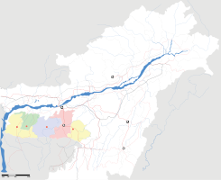
Ubicación de Williamnagar en Megalaya.
25°29′50″N 90°37′05″E / 25.49722, 90.61806Coordenadas: 25°29′50″N 90°37′05″E / 25.49722, 90.61806
Entidad Localidad
 • País Bandera de India India
 • Estado Megalaya
 • Distrito East Garo Hills
Altitud  
 • Media 276 msnm
Población (Est.2010[1] )  
 • Total 25.653 hab.
Huso horario IST UTC +5:30
PIN[2] 794111
Código de área 3658

Williamnagar es una localidad de la India, centro administrativo del distrito de East Garo Hills,en el estado de Megalaya.

Contenido

Geografía

Se encuentra a una altitud de 276 msnm a 235 km de la capital estatal, Shillong, en la zona horaria UTC +5:30.

Demografía

Según estimación 2010 contaba con una población de 25 653 habitantes.[1]

Referencias

Enlaces externos


Wikimedia foundation. 2010.

Игры ⚽ Нужна курсовая?

Mira otros diccionarios:

  • Williamnagar — Infobox Indian Jurisdiction native name = Williamnagar | type = city | latd = | longd = state name = Meghalaya district = East Garo Hills leader title = leader name = altitude = population as of = 2001 population total = 18,251| population… …   Wikipedia

  • East Garo Hills district — East Garo Hills is an administrative district in the state of Meghalaya in India. The district headquarters are located at Williamnagar. The district occupies an area of 2603 km² and has a population of 247,555 (as of 2001).The East Garo Hills… …   Wikipedia

  • Meghalaya —   State   Seal …   Wikipedia

  • Nongpoh —   city   …   Wikipedia

  • Nongstoin —   city   …   Wikipedia

  • Someshwari River — (also spelt Someswari) ( bn. সোমেশ্বরী নদী), known as Simsang River in the Indian state of Meghalaya, is a major river in the Garo Hills of Meghalaya and Netrakona District of Bangladesh. It divides the Garo Hills into two parts. MeghalayaLocally …   Wikipedia

  • Liste der Distrikte in Indien — Die Liste der Distrikte in Indien ist nach Bundesstaaten und Unionsterritorien sortiert. Indien besteht aus 601 Distrikten. Die Distriktkürzel entsprechen der Norm ISO 3166 2 für die Kodierung subnationaler Einheiten. Sie werden für… …   Deutsch Wikipedia

  • Meghalaya — Status: Bundesstaat Hauptstadt: Shillong Fläche: 22.429 km² Einwohner: 2.964.007 (2011) Bevölkerungsdichte …   Deutsch Wikipedia

  • Parque Nacional de Nokrek — Saltar a navegación, búsqueda Parque Nacional de Nokrek …   Wikipedia Español

  • List of districts of Meghalaya — The Indian state of Meghalaya is divided into 7 districts. Contents 1 History 2 Administrative structure 3 Alphabetical listing 4 References …   Wikipedia

Compartir el artículo y extractos

Link directo
Do a right-click on the link above
and select “Copy Link”