- Yardley Gobion
-
Yardley Gobion Pueblo y parroquia civil del Reino Unido Ubicación en Northamptonshire.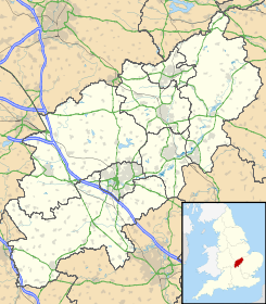
 Yardley Gobion
Coordenadas: Entidad Pueblo y parroquia civil • País  Reino Unido
• Nación constitutiva Inglaterra • Región Midlands del Este • Condado Northamptonshire • Distrito South Northamptonshire Población (2001) • Total 1.329 hab. Código postal NN12 Prefijo telefónico 01908 Yardley Gobion es un pueblo y una parroquia civil del distrito de South Northamptonshire, en el condado de Northamptonshire (Inglaterra).
Demografía
Según el censo de 2001,[1] Yardley Gobion tenía 1329 habitantes (674 varones y 655 mujeres). 283 (21,29%) de ellos eran menores de 16 años, 960 (72,24%) tenían entre 16 y 74, y 86 (6,47%) eran mayores de 74. La media de edad era de 38,28 años. De los 1046 habitantes de 16 o más años, 229 (21,89%) estaban solteros, 660 (63,1%) casados, y 157 (15,01%) divorciados o viudos. 704 habitantes eran económicamente activos, 687 de ellos (97,59%) empleados y otros 17 (2,41%) desempleados. Había 8 hogares sin ocupar, 501 con residentes y 3 eran alojamientos vacacionales o segundas residencias.
Referencias
- ↑ «Yardley Gobion» (en inglés). Office for National Statistics. Consultado el 26 de junio de 2011.
Categoría:- Localidades de Northamptonshire

Wikimedia foundation. 2010.