Cabucgayan

Cabucgayan

Cabucgayan

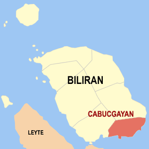
Mapa de Bilirán mostrando la ubicación de Cabucgayan

Cabucgayan es un municipio de quinta clase en la provincia de Bilirán, Filipinas. Conforme al censo de 2000, tiene una población de 17.691 habitantes distribuidos en 3.372 viviendas.

El nombre de "Cabucgayan" deriva de un caracol llamado "bukgay." En waray, para transformar un sustantivo singular al plural, el artículo "ka" se agrega antes de la palabra, y el artículo "an" detrás de la palabra, cumpliendo la función de sufijo. Kabukgayan, por tanto, alude a un lugar donde hay muchos caracoles.

Barangayes

Cabucgayan se subdivide administrativamente en 13 barangayes.

  • Balaquid
  • Baso
  • Bunga
  • Caanibongan
  • Casiawan
  • Esperanza (Pob.)
  • Langgao
  • Libertad
  • Looc
  • Magbangon (Pob.)
  • Pawikan
  • Salawad
  • Talibong

Enlaces externos

Obtenido de "Cabucgayan"

Wikimedia foundation. 2010.

Игры ⚽ Поможем написать курсовую

Mira otros diccionarios:

  • Cabucgayan — Municipality of Cabucgayan Lage von Cabucgayan in der Provinz Biliran Basisdaten Bezirk …   Deutsch Wikipedia

  • Cabucgayan — Original name in latin Cabucgayan Name in other language Cabucgayan State code PH Continent/City Asia/Manila longitude 11.47194 latitude 124.575 altitude 9999 Population 2700 Date 2011 07 31 …   Cities with a population over 1000 database

  • Cabucgayan, Biliran — Infobox Philippine municipality infoboxtitle = Municipality of Cabucgayan sealfile = locatormapfile = Ph locator biliran cabucgayan.png caption = Map of Biliran showing the location of Cabucgayan. region = Eastern Visayas province = Biliran… …   Wikipedia

  • Legislative districts of Leyte — Philippines This article is part of the series: Politics and government of the Philippines …   Wikipedia

  • Biliran Island — Infobox Islands name = Biliran Island image caption = NASA Landsat image of Biliran. native name = native name link = locator Location map|Philippines|lat=11.523|long=124.535|width=175 map custom = yes location = South East Asia coordinates=… …   Wikipedia

  • PH-BIL — Lage der Provinz Biliran Biliran ist eine Insel und seit 1992 eine eigenständige Provinz der Philippinen. Die Provinzhauptstadt ist Naval. Vor ihrer politischen Eigenständigkeit gehörte die Insel zur Provinz Leyte. Die Insel liegt in den… …   Deutsch Wikipedia

  • Biliran (volcano) — Biliran Elevation 1,301 m (4,268 ft) Location Location …   Wikipedia

  • Biliran — This article is about the province. For the municipality, see Biliran, Biliran. For the Island see Biliran Island. Infobox Philippine province name = Biliran sealfile = Ph seal biliran.png region = Eastern Visayas (Region VIII) capital = Naval… …   Wikipedia

  • Culaba, Biliran — Map of Biliran showing the location of Culaba Culaba is a 5th class municipality in the province of Biliran, Philippines. According to the 2000 census, it has a population of 11,506 people in 2,193 households. Barangays Culaba is politically… …   Wikipedia

  • Maripipi, Biliran — Map of Biliran showing the location of Maripipi Maripipi is a 5th class municipality in the province of Biliran, Philippines. According to the 2000 census, it has a population of 8,319 people in 1,562 households. Barangays Maripipi is politically …   Wikipedia

Compartir el artículo y extractos

Link directo
Do a right-click on the link above
and select “Copy Link”