Kamp-Lintfort

Kamp-Lintfort
Armas Mapa
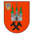
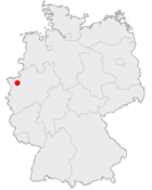
Wappen des Kamp-Lintfort Lage des Kamp-Lintfort en Alemania

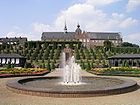
Kloster_Kamp_02.jpg

Datos básicos
Bundesland: Renania del Norte-Westfalia
Distrito: Wesel
Superficie: 63,16 km²
Altura: 33 m
Habitantes: 39.177 (31 de diciembre de 2007)
Densidad poblacional: 620 Habitantes por km²
Código postal: 47475
Prefijo telefónico: 0 28 42
Código administrativo: 05 1 70 020
Matrícula: WES
Dirección de
la administración:
Am Rathaus 2
47475 Kamp-Lintfort
Website: www.kamp-lintfort.de

La ciudad de Kamp-Lintfort pertenece al distrito de Wesel en el estado federal de Nordrhein-Westfalen (Alemania). La ciudad se ubica en la parte norte del Niederrhein y forma parte del Ruhrgebiet. Kamp-Lintfort es una ciudad de gran industria minera. Además en ella se ubica el monasterio Kamp perteneciente a la orden cisterciense.

Geografía

Kamp-Lintfort está en la tierra baja del Niederrhein. Está al lado de Duisburg

El barrios son:

  • Lintfort
  • Kamp
  • Eyll
  • Geisbruch
  • Gestfeld
  • Hoerstgen
  • Kamperbruch
  • Kamperbrück
  • Rossenray
  • Saalhoff

Ciudades hermanadas


Wikimedia foundation. 2010.

Игры ⚽ Поможем написать курсовую

Mira otros diccionarios:

  • Kamp-lintfort — Maisons de mineurs et les Trois géants blancs à Kamp Lintfort Kamp Lintfort est une ville d Allemagne, dans l arrondissement de Wesel en Rhénanie du Nord Westphalie. Elle est à 8 km au nord ouest de Moers. Population: 39 594 habitants (30 juin… …   Wikipédia en Français

  • Kamp-Lintfort — Kamp Lịntfort,   Stadt im Kreis Wesel, Nordrhein Westfalen, links des Niederrheins, 25 m über dem Meeresspiegel, 40 400 Einwohner; Ordensmuseum Abtei Kamp, Geologisches Museum; Steinkohlenbergbau, Elektroindustrie, Kommunikationstechnologie.  … …   Universal-Lexikon

  • Kamp-Lintfort — Wappen Deutschlandkarte …   Deutsch Wikipedia

  • Kamp-lintfort — Wappen Deutschlandkarte …   Deutsch Wikipedia

  • Kamp-Lintfort — Infobox German Location Art = Stadt Name = Kamp Lintfort image photo = Kamplintfort.jpg imagesize = 250px image caption = Old and new in Kamp Lintfort Wappen = Stadtwappen der Stadt Kamp Lintfort.png lat deg = 51 |lat min = 30 |lat sec = 00 lon… …   Wikipedia

  • Kamp-Lintfort — Original name in latin Kamp Lintfort Name in other language Kamp Lintfort, Lapangan Terbang Kamp Lintfort, kan pu lin te fu er te, kmp lyntfwrt, Камп Линтфорт, State code DE Continent/City Europe/Berlin longitude 51.50467 latitude 6.54588… …   Cities with a population over 1000 database

  • Kamp-Lintfort — 51° 30′ 00″ N 6° 32′ 00″ E / 51.5, 6.53333 …   Wikipédia en Français

  • Kamp-Lintfort Gladiators — Stadt: Kamp Lintfort Gegründet: 1982 Aufgelöst: 1994 Größte Erfolge 1990 3. Platz, 2. Bundesliga West …   Deutsch Wikipedia

  • Kamp-Lintfort Hoerstgen — Hoerstgen ist der westlichste Stadtteil von Kamp Lintfort. Es ist ein typisches Straßendorf mit einer evangelischen Kirche in der Ortsmitte. Diese ist sehr bekannt für ihre gut erhaltene Thomas Weidtmann Orgel aus dem Jahre 1731. Die Hoerstgener… …   Deutsch Wikipedia

  • Flugplatz Kamp-Lintfort — BW …   Deutsch Wikipedia

Compartir el artículo y extractos

Link directo
Do a right-click on the link above
and select “Copy Link”