Oeste Subregion — Map showing the location of the Oeste subregion … Wikipedia
Oeste (desambiguación) — Oeste hace referencia a varios artículos: Oeste. Punto cardinal. Oeste (subregión). Subregión estadística portuguesa Oeste de Estados Unidos. El Oeste, región geográfica estadounidense. Oeste de Filadelfia. Sección de la ciudad de Filadelfia.… … Wikipedia Español
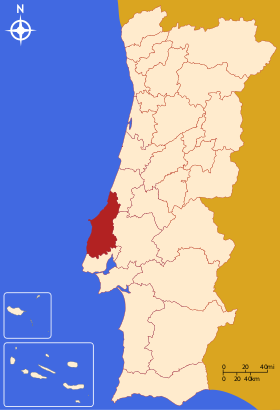
Oeste — may refer to: Contents 1 Places 1.1 Brazil 1.2 Estonia 1.3 Portugal Places Brazil … Wikipedia
Oeste — Lage von Oeste Oeste (portugiesisch für Westen) ist eine statistische Subregion Portugals. Sie ist Teil der Região Centro und auf die Distrikte Leiria und Lissabon aufgeteilt. Im Osten grenzen Pinhal Litoral und Lezíria do Tejo, im Süden Grande… … Deutsch Wikipedia
Subregión — Geoesquema de la ONU, creado por la División Estatísdica de las Naciones Unidas. Por razones de coherencia estadística cada país tiene su territorio integramente en solo una subregión, por ej. Rusia en Europa del Este), aunque también tenga parte … Wikipedia Español
Cávado Subregion — Map showing the location of the Cávado subregion Cávado is a subregion that is integrated in the Portuguese region of Norte. It has 6 municipalities or Concelhos (in Portuguese) and is centered in the city of Braga (pop. 153,000). With an area of … Wikipedia
Grande Porto Subregion — Map showing the location of the Grande Porto subregion Grande Porto or Greater Porto is a Portuguese NUTS3 subregion, integrating the NUTS2 region of Norte, in Portugal. It corresponds to 11 municipalities out of 16, the other 5 in Entre Douro e… … Wikipedia
Douro (Subregion) — Lagekarte der Subregion Douro Douro ist eine statistische Subregion Portugals. Sie ist Teil der Região Norte, und setzt sich aus Kreisen der Distrikte Bragança, Vila Real, Viseu und Guarda zusammen. Im Norden grenzt die Subregion Alto Trás os… … Deutsch Wikipedia
Cova da Beira Subregion — Map showing the location of the Cova da Beira subregion Cova da Beira is a NUTS3 subregion of Portugal integrated in the NUTS2 Centro region. It lies in the fertile valley between the Serra da Estrela and Gardunha mountains. It covers an area of… … Wikipedia
Minho-Lima Subregion — Map showing the location of the Minho Lima subregion Minho Lima is a Portuguese NUTS3 subregion, belonging to Norte Region, between the Minho River and Lima River in the northern part of Portugal. It corresponds to the historical region of Alto… … Wikipedia
 Portugal