- Roes Welcome Sound
-
Roes Welcome Sound
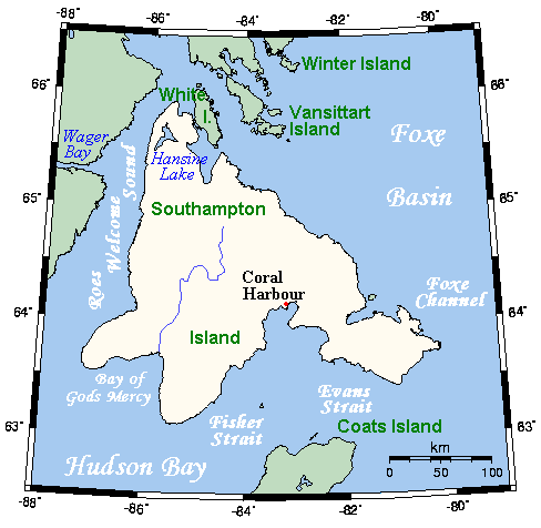
 Mapa de isla Somersert, con el Roes Welcome Sound a la izquierda
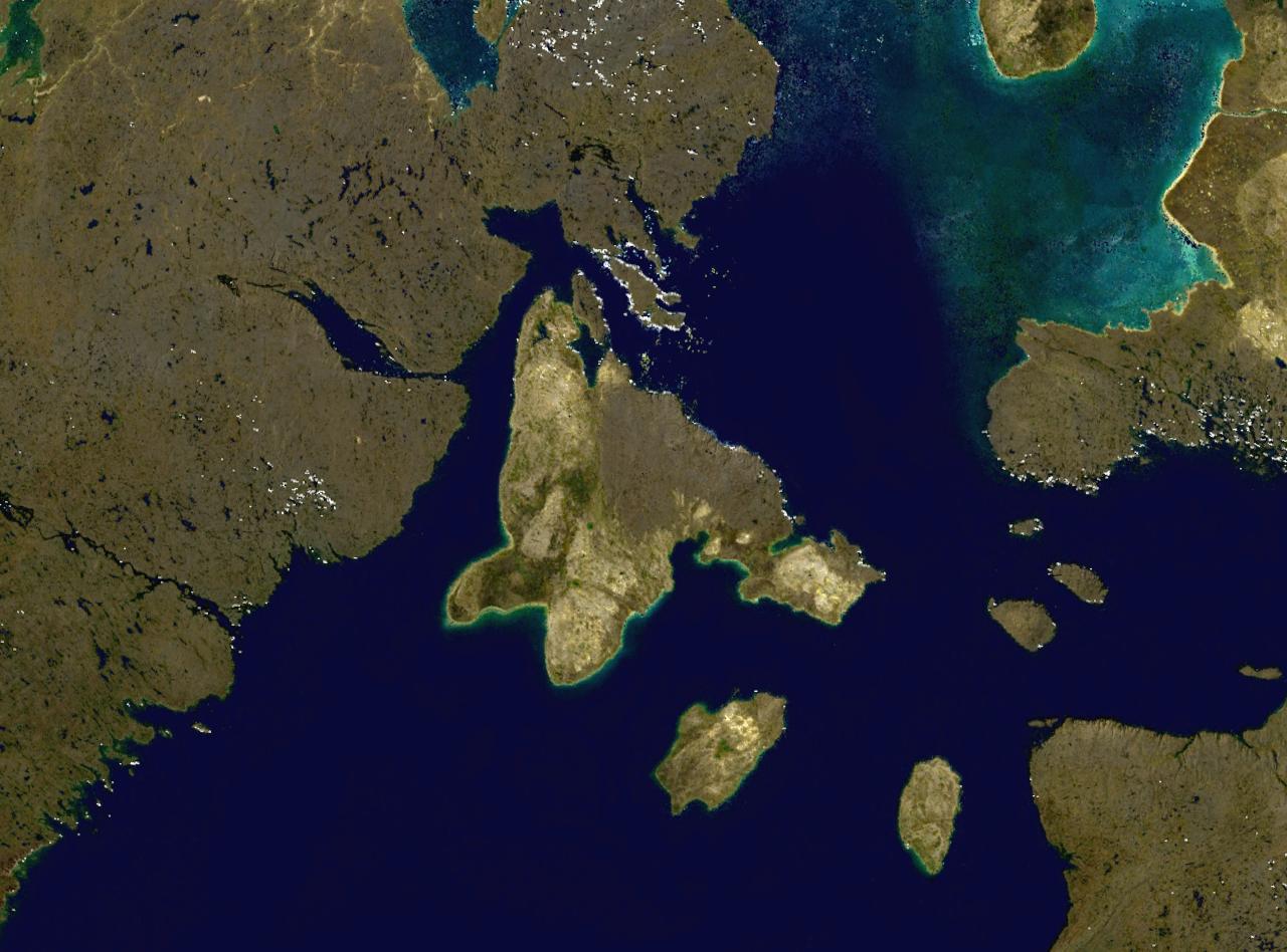
 Foto de satélite de isla Somersert, con el Roes Welcome Sound a la izquierda
Roes Welcome Sound[1] o estrecho de la Bienvenida a Roes es un cuerpo de mar localizado en el ártico canadiense, en la parte septentrional de la bahía de Hudson.
Contenido
Geografía
El estrecho Roes Welcome Sound está localizado entre el continente e isla Southampton, 200 km al norte de isla Mármol.[2]
Bordea isla Southampton por su costa occidental y es un paso entre la bahía de Hudson, al sur, y Foxe Basin, al norte. En su parte más septentrional, se encuentra Repulse Bay. El estrecho mide unos 290 km de largo, y 24 km de ancho.[3] Administrativamente, pertenece al territorio autónomo de Nunavut.
Historia
El estrecho lleva el nombre de Sir Thomas Roe, amigo y patrocinador de la expedición Ártico de 1631 del explorador inglés Luke Fox.[4] [5]
El capitán William Edward Parry, tratando de encontrar el Paso del Noroeste durante su viaje de 1821, escribió:
Examinando las cartas, creo probable que un día también aparecerá una comunicación entre esta entrada (Prince Regent's) y la bahía de Hudson, ya sea a través del amplio e inexplorado canal llamado Sir Thomas Roe's Welcome, o a través de Repulse Bay, que todavía no se han reconocido de manera satisfactoria.
Naturaleza
Roes Welcome Sound es lugar de paso de la migración de las ballenas de Groenlandia, ruta que se examina en la publicación de Gillies W. Ross de 1974 Distribution, Migration, and Depletion of Bowhead Whales in Hudson Bay, 1860 to 1915.[8]
Véase
Referencias
- Todo o parte de este artículo fue creado a partir de la traducción del artículo Roes Welcome Sound de la Wikipedia en inglés, bajo licencia Creative Commons Compartir Igual 3.0. y GFDL.
- ↑ La voz inglesa «sound» no tiene traducción directa al español, aunque a veces se hace como estrecho o bahía. En geografía marina, un «sound» es un gran entrante de mar u océano, que es mayor que una bahía, más profundo que una cuenca marina, y más amplio que un fiordo. A veces se puede identificar con un estrecho o canal entre dos masas de tierra.
- ↑ «Marble Island, experience the mystery». marbleisland.ca. Consultado el 2008-04-09.
- ↑ «Roes Welcome Sound». The Columbia Gazetteer of North America (2000). Consultado el 2008-04-09.
- ↑ «Thomas James and Luke Foxe». princeton.edu. Consultado el 2008-04-09.
- ↑ «JSTOR: The History of American Ornithology before Audubon». Consultado el 2008-04-09.
- ↑ Smucker, Samuel Mosheim; Allison, W.L. (1886). Arctic explorations and discoveries during the nineteenth century. Being detailed accounts of the several expeditions to the north seas, both English and American, conducted by Ross, Parry, Back, Franklin, M'Clure, Dr. Kane, and others, including the long and fruitless efforts and failures in search of Sir John Franklin. Ed. and completed to 1855. New York: J.W. Lovell.
- ↑ «On an inspection of the charts, I think it will also appear probable that a communication will one day be found to exist between this inlet (Prince Regent's) and Hudson's Bay, either through the broad and unexplored channel called Sir Thomas Roe's Welcome, or through Repulse Bay, which has not yet been satisfactorily examined.»
- ↑ Ross, W.G. (1974). «Distribution, Migration, and Depletion of Bowhead Whales in Hudson Bay, 1860 to 1915» Arctic and Alpine Research. Vol. 6. n.º 1. pp. 85-98. JSTOR.
Categorías: Golfos y bahías del océano Ártico | Estrechos de Canadá | Geografía de Nunavut
Wikimedia foundation. 2010.