Souderton

Souderton
Souderton
Borough de los Estados Unidos
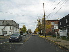
Pennsylvania State Route 113 In Souderton.jpgRuta Estatal de Pensilvania 113
Souderton
Souderton
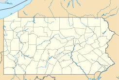
Ubicación en el condado de Montgomery en el estado de Pensilvania
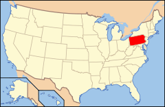
Map of USA PA.svg
Ubicación de Pensilvania en EE. UU.
40°18′37″N 75°19′18″O / 40.31028, -75.32167Coordenadas: 40°18′37″N 75°19′18″O / 40.31028, -75.32167
Entidad Borough
 • País Bandera de los Estados Unidos Estados Unidos
 • Estado Flag of Pennsylvania.svg Pensilvania
 • Condado Montgomery
Superficie  
 • Total 2,9 km²
 • Tierra 2,9 km²
 • Agua (0%) 0 km²
Altitud  
 • Media 122 msnm
Población (2000)  
 • Total 6.730 hab.
 • Densidad 2,322.7 hab/km²
Huso horario Este: UTC-5
 • en verano UTC-4
Código ZIP 18964
Código de área 215

Souderton es un borough ubicado en el condado de Montgomery en el estado estadounidense de Pensilvania. En el año 2000 tenía una población de 6,730 habitantes y una densidad poblacional de 2,322.7 personas por km².[1]

Contenido

Geografía

Está situada en las coordenadas 40°18′37″N 75°19′18″O / 40.31028, -75.32167Coordenadas: 40°18′37″N 75°19′18″O / 40.31028, -75.32167 y tiene una superficie de 2,9 km2.

Demografía

A partir del censo de 2000, había 6.730 personas, 2.635 hogares y 1.765 familias que residían en la ciudad. La densidad de población fue 2,320.1/km2. La composición racial de la ciudad era 91,69% blanco, 1,00% afroamericanos, 0,19% americanos nativos, 3,98% asiáticos, 0,03% De las islas del Pacífico, 1,86% de otras razas, y el 1,25% de dos o más razas. Hispanos o latinos de cualquier raza eran el 4,29% de la población.

Gobierno

Está gobernada por un alcalde y nueve conserjes de ciudad.

Referencias

  1. «Encuentra un condado» (en inglés). Asociación Nacional de Condados (11 de julio de 2011). Consultado el 11 de julio de 2011.

Enlaces externos


Wikimedia foundation. 2010.

Игры ⚽ Нужно сделать НИР?

Mira otros diccionarios:

  • Souderton — Souderton, PA U.S. borough in Pennsylvania Population (2000): 6730 Housing Units (2000): 2720 Land area (2000): 1.118733 sq. miles (2.897506 sq. km) Water area (2000): 0.000000 sq. miles (0.000000 sq. km) Total area (2000): 1.118733 sq. miles… …   StarDict's U.S. Gazetteer Places

  • Souderton, PA — U.S. borough in Pennsylvania Population (2000): 6730 Housing Units (2000): 2720 Land area (2000): 1.118733 sq. miles (2.897506 sq. km) Water area (2000): 0.000000 sq. miles (0.000000 sq. km) Total area (2000): 1.118733 sq. miles (2.897506 sq. km) …   StarDict's U.S. Gazetteer Places

  • Souderton — Original name in latin Souderton Name in other language State code US Continent/City America/New York longitude 40.31177 latitude 75.32518 altitude 126 Population 6618 Date 2011 05 14 …   Cities with a population over 1000 database

  • Souderton Area School District — covers an area of almost 50 square miles in Montgomery County, Pennsylvania. By 2005, the population of the district had exceeded 41,000. The Souderton Area School District is made up of 3 secondary schools and 7 elementary schools. A new high… …   Wikipedia

  • Souderton, Pennsylvania — Geobox Borough name = Borough of Souderton native name = other name = other name1 = category = Borough image size = image caption = flag size = symbol type = Seal symbol = SoudertonSeal.png symbol size = nickname = motto = country = United States …   Wikipedia

  • Souderton Area High School — Infobox School name = Souderton Area High School native name = latin name = imagesize = caption = location = Souderton Area School District streetaddress = 41 North School Lane region = city = Souderton state = PA province = county = Montgomery… …   Wikipedia

  • 18964 — Souderton, Pa (Miscellaneous » ZIP Codes) …   Abbreviations dictionary

  • National Register of Historic Places listings in Montgomery County, Pennsylvania — Location of Montgomery County in Pennsylvania This is a list of the National Register of Historic Places listings in Montgomery County, Pennsylvania. This is intended to be a complete list of the properties and districts on National Register of… …   Wikipedia

  • Lehigh Valley Transit — The Lehigh Valley Transit (LVT) was an interurban trolleythat ran a forty five mile route from Allentown toUpper Darby Philadelphia, Pennsylvania. It suddenly abandoned interurban operations September 1951 with no notice to waiting riders the… …   Wikipedia

  • Montgomery County, Pennsylvania — Flag …   Wikipedia

Compartir el artículo y extractos

Link directo
Do a right-click on the link above
and select “Copy Link”