Albrightsville

Albrightsville
Albrightsville
Lugar designado por el censo de los Estados Unidos
Albrightsville
Albrightsville
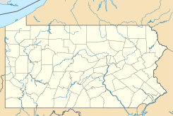
Ubicación en el condado de Carbon en Pensilvania
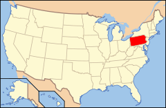
Ubicación de Pensilvania en EE. UU.
41°0′51″N 75°36′2″O / 41.01417, -75.60056Coordenadas: 41°0′51″N 75°36′2″O / 41.01417, -75.60056
Entidad Lugar designado por el censo
 • País Bandera de los Estados Unidos Estados Unidos
 • Estado Flag of Pennsylvania.svg Pensilvania
 • Condado Carbon
Fundación 30 de agosto de 2010
Altitud  
 • Media 460 msnm
Población (2010)  
 • Total 202 hab.
Huso horario Este: UTC-5
 • en verano UTC-4
Código ZIP 18210

Albrightsville es un lugar designado por el censo ubicado en el condado de Carbon en el estado estadounidense de Pensilvania. En el año 2010 tenía una población de 202 habitantes.[1]

Geografía

Albrightsville se encuentra ubicado en las coordenadas 41°0′51″N 75°36′2″O / 41.01417, -75.60056Coordenadas: 41°0′51″N 75°36′2″O / 41.01417, -75.60056.[2]

Referencias

  1. «Encuentra un condado» (en inglés). Asociación Nacional de Condados (11 de julio de 2011). Consultado el 11 de julio de 2011.
  2. «American FactFinder» (en inglés). Oficina del Censo de los Estados Unidos. Consultado el 11 de julio de 2011.

Enlaces externos


Wikimedia foundation. 2010.

Игры ⚽ Нужен реферат?

Mira otros diccionarios:

  • 18210 — Albrightsville, Pa (Miscellaneous » ZIP Codes) …   Abbreviations dictionary

  • Carbon County, Pennsylvania — Location in the state of Pennsylvania …   Wikipedia

  • Jim Thorpe, Pennsylvania — Coordinates: 40°52′23″N 75°44′11″W / 40.87306°N 75.73639°W / 40.87306; 75.73639 …   Wikipedia

  • Mahoning Township, Carbon County, Pennsylvania — For other Pennsylvania townships of the same name, see Mahoning Township, Pennsylvania. Coordinates: 40°50′00″N 75°44′58″W / 40.8333333°N 75.74944°W …   Wikipedia

  • Nesquehoning, Pennsylvania — Coordinates: 40°52′05″N 75°49′27″W / 40.86806°N 75.82417°W / 40.86806; 75.82417 …   Wikipedia

  • North American blizzard of 2005 — Abandoned cars line Route 6A in Yarmouth Port, Massachusetts, one of the hardest hit areas, receiving as much as 40 inches (1 m) of snow during the Blizzard of 2005 …   Wikipedia

  • Interstate 476 — PA 9 redirects here. PA 9 may also refer to Pennsylvania s 9th congressional district. For the 1920s route, see Pennsylvania Route 9 (1920s). Interstate 476 …   Wikipedia

  • CSN International translators — Main article: CSN International CSN International is relayed by 366 low powered translators nationwide: Callsign MHz City of license Additional Information W214BQ 90.7 Brentwood, TN FCC …   Wikipedia

  • National Register of Historic Places listings in Carbon County, Pennsylvania — Location of Carbon County in Pennsylvania This is a list of the National Register of Historic Places listings in Carbon County, Pennsylvania. This is intended to be a complete list of the properties and districts on the National Register of… …   Wikipedia

  • Normal Square, Pennsylvania — is a village in western Mahoning Township, Carbon County located on Route 443. The Mahoning Creek flows through it eastward to the Lehigh River. It uses the Lehighton zip code of 18235. New Mahoning, Summit Hill Jim Thorpe, Lehighton, Packerton …   Wikipedia

Compartir el artículo y extractos

Link directo
Do a right-click on the link above
and select “Copy Link”