Alleghenyville

Alleghenyville
Alleghenyville
Lugar designado por el censo de los Estados Unidos
Alleghenyville
Alleghenyville
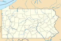
Ubicación en el condado de Berks en Pensilvania
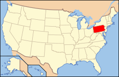
Ubicación de Pensilvania en EE. UU.
40°14′4″N 75°58′42″O / 40.23444, -75.97833Coordenadas: 40°14′4″N 75°58′42″O / 40.23444, -75.97833
Entidad Lugar designado por el censo
 • País Bandera de los Estados Unidos Estados Unidos
 • Estado Flag of Pennsylvania.svg Pensilvania
 • Condado Berks
Fundación 15 de julio de 2010
Altitud  
 • Media 155 msnm
Población (2010)  
 • Total 1.134 hab.
Huso horario Este: UTC-5
 • en verano UTC-4
Código ZIP 19540

Alleghenyville es un lugar designado por el censo ubicado en el condado de Berks en el estado estadounidense de Pensilvania. En el año 2010 tenía una población de 1.134 habitantes.[1]

Geografía

Alleghenyville se encuentra ubicado en las coordenadas 40°14′4″N 75°58′42″O / 40.23444, -75.97833Coordenadas: 40°14′4″N 75°58′42″O / 40.23444, -75.97833.[2]

Referencias

  1. «Encuentra un condado» (en inglés). Asociación Nacional de Condados (11 de julio de 2011). Consultado el 11 de julio de 2011.
  2. «American FactFinder» (en inglés). Oficina del Censo de los Estados Unidos. Consultado el 11 de julio de 2011.

Enlaces externos


Wikimedia foundation. 2010.

Игры ⚽ Нужно сделать НИР?

Mira otros diccionarios:

  • Alleghenyville — Original name in latin Alleghenyville Name in other language State code US Continent/City America/New York longitude 40.23426 latitude 75.98855 altitude 171 Population 1134 Date 2011 05 14 …   Cities with a population over 1000 database

  • Berks County, Pennsylvania — Reading skyline …   Wikipedia

  • Douglass Township, Berks County, Pennsylvania — For other uses, see Douglass Township (disambiguation). Coordinates: 40°17′23″N 75°40′47″W / 40.28972°N 75.67972°W / …   Wikipedia

  • Marion Township, Berks County, Pennsylvania — For other Pennsylvania townships with similar names, see Marion Township, Pennsylvania. Coordinates: 40°23′00″N 76°15′29″W / 40.3833333°N 76.25806°W …   Wikipedia

  • Mohnton, Pennsylvania — Coordinates: 40°17′10″N 75°59′09″W / 40.28611°N 75.98583°W / 40.28611; 75.98583 …   Wikipedia

  • Mount Penn, Pennsylvania — Coordinates: 40°19′46″N 75°53′26″W / 40.32944°N 75.89056°W / 40.32944; 75.89056 …   Wikipedia

  • New Morgan, Pennsylvania — Coordinates: 40°10′50″N 75°52′14″W / 40.18056°N 75.87056°W / 40.18056; 75.87056 …   Wikipedia

  • Morgantown, Pennsylvania — Odd Fellows Hall Morgantown is a populated place in Caernarvon Township, Berks County, Pennsylvania, United States with a zip code of 19543. It is at an elevation of 597 ft (182 m) at 40° 9 18 N and 75°53 23 W. General History Morgantown was …   Wikipedia

  • National Register of Historic Places listings in Berks County, Pennsylvania — Location of Berks County in Pennsylvania This is a list of the National Register of Historic Places listings in Berks County, Pennsylvania. This is intended to be a complete list of the properties and districts on National Register of Historic… …   Wikipedia

  • Douglassville, Pennsylvania — Old St. Gabriel s Episcopal Church, founded 1720. This building built in 1801. Douglassville is a community in Amity, Union Townships, and Douglass Townships Berks County, Pennsylvania, United States. Douglassville is situated along U.S. Route… …   Wikipedia

Compartir el artículo y extractos

Link directo
Do a right-click on the link above
and select “Copy Link”