Chattaroy (Washington)

Chattaroy (Washington)
Chattaroy
Área no incorporada de los Estados Unidos
Chattaroy
Chattaroy
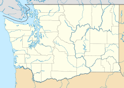
Ubicación en el condado de Spokane en el estado de Washington
Map of USA WA.svg
Ubicación de Washington en EE. UU.
47°53′24″N 117°21′0″O / 47.89, -117.35Coordenadas: 47°53′24″N 117°21′0″O / 47.89, -117.35
Entidad Área no incorporada
 • País Bandera de los Estados Unidos Estados Unidos
 • Estado Flag of Washington.svg Washington
 • Condado Spokane
Huso horario Pacífico: UTC-8
 • en verano UTC-7

Chattaroy es un área no incorporada ubicada en el condado de Spokane en el estado estadounidense de Washington.

Geografía

Chattaroy se encuentra ubicado en las coordenadas 47°53′24″N 117°21′0″O / 47.89, -117.35Coordenadas: 47°53′24″N 117°21′0″O / 47.89, -117.35.[1]

Referencias

  1. «American FactFinder» (en inglés). Oficina del Censo de los Estados Unidos. Consultado el 11 de julio de 2011.

Enlaces externos


Wikimedia foundation. 2010.

Игры ⚽ Нужно сделать НИР?

Mira otros diccionarios:

  • Chattaroy, Washington — Chattaroy is an unincorporated community in Spokane County, Washington, United States. The town is located on U.S. Route 2 approximately 10 miles north northeast of Spokane at the confluence of the Little Spokane River and Dragoon Creek. History… …   Wikipedia

  • Chattaroy — may refer to: Chattaroy, Washington Chattaroy, West Virginia This disambiguation page lists articles about distinct geographical locations with the same name. If an internal link led you here, you may wish to c …   Wikipedia

  • List of unincorporated communities in Washington — This is a list of unincorporated communities in the U.S. state of Washington which are not incorporated municipalities. Incorporated municipalities in the state are listed separately in a list of cities and list of towns. Contents 1 Census… …   Wikipedia

  • Milan, Washington — Milan (pronounced /ˈmaɪlɨn/, US dict: mī′·lĭn) is an unincorporated community in Spokane County, Washington, United States. Milan is a rural community located along the Burlington Northern Railroad, east of Deer Park. It is named after… …   Wikipedia

  • Cheney, Washington —   City   Location of Cheney, Washington …   Wikipedia

  • Primary State Highway 6 (Washington) — Primary State Highway 6 Pend Oreille Highway, Newport Highway PSH 6 highlighted in red …   Wikipedia

  • Spokane County, Washington — Infobox U.S. County county = Spokane County state = Washington map size = 225 founded = January 29, 1858 and October 30, 1879 seat = Spokane | area total sq mi =1781 area land sq mi =1764 area water sq mi =17 area percentage = 0.96% census yr =… …   Wikipedia

  • Liberty Lake, Washington —   City   Location of Libe …   Wikipedia

  • Marshall, Washington —   Unincorporated community   …   Wikipedia

  • Mica, Washington —   Unincorporated community   …   Wikipedia

Compartir el artículo y extractos

Link directo
Do a right-click on the link above
and select “Copy Link”