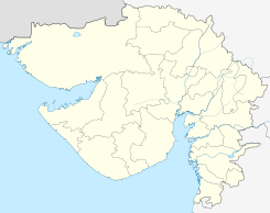
Chotila — town … Wikipedia
Chotila — Original name in latin Chotila Name in other language Chotila State code IN Continent/City Asia/Kolkata longitude 22.42347 latitude 71.19641 altitude 210 Population 15197 Date 2013 02 08 … Cities with a population over 1000 database
Surendranagar district — Surendranagar situated between 22º 43 N Latitude and 71º 43 E Longitude can be rightly termed as gateway to Saurashtra. It is home to 15,15,148 people. Surendranagar is also known as Zalawad, Because the city of Surendranagar was operated by ZALA … Wikipedia
Hotel Silver Sand — (Chotila,Индия) Категория отеля: 3 звездочный отель Адрес: Limda chowk, opp. tata … Каталог отелей
Gujarat — This article is about the Indian state. For the district in Pakistan, see Gujrat District. For the city in Pakistan, see Gujrat. Gujarat ગુજરાત State … Wikipedia
Rabari — Asia in 1200 AD, showing the Yadava Dynasty and its neighbors. Members of the Rabari or Rewari live throughout the Rajasthan, Gujarat, Punjab, Harayana, Uttar Pradesh and Madhya Pradesh states in India. There are many other Rabari families who… … Wikipedia
Kathiawar Agency — Kathiawar (1909, Besitzungen Barodas in gelb) Die 60.488 km² große Kathiawar Agency war eine verwaltungsmäßige Gruppierung von indischen Fürstenstaaten zur Zeit der Kolonialherrschaft auf der gleichnamigen Halbinsel. Sie grenzte im Osten an die… … Deutsch Wikipedia
Chamunda — For the village in Nepal, see Chamunda, Nepal. For the skipper butterfly genus, see Chamunda (butterfly). Chamunda A Hoysala sculpture of Chamunda, Halebidu. Goddess of War and epidemics of pestilent diseases, famines, and other disasters … Wikipedia
List of Indian Princely States — Hundreds of princely states in British India existed prior to the independence of India and Pakistan (including the present Bangladesh) in 1947, ruled by semi independent potentates. Only four of the largest of these states were still directed by … Wikipedia
Amreli — Infobox Indian Jurisdiction native name = Amreli | type = city | latd = 21.62 | longd = 71.23 locator position = right | state name = Gujarat district = Amreli leader title = |m.p.leader name = |Virji Thumaraltitude = 128 population as of = 2001… … Wikipedia
 Chotila
 India
India