- Fritton and St. Olaves
-
Fritton and St. Olaves Parroquia civil del Reino Unido Ubicación en Norfolk.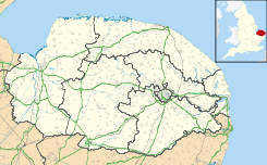
 Fritton and St. Olaves
Coordenadas: Entidad Parroquia civil • País  Reino Unido
• Nación constitutiva Inglaterra • Región Este de Inglaterra • Condado Norfolk • Distrito Great Yarmouth Población (2001) • Total 543 hab. Código postal NR31 Prefijo telefónico 01493 Fritton and St. Olaves es una parroquia civil del distrito de Great Yarmouth, en el condado de Norfolk (Inglaterra). En ella están ubicados los pueblos de Fritton y St. Olaves.
Demografía
Según el censo de 2001,[1] Fritton and St. Olaves tenía 543 habitantes (283 varones y 260 mujeres). 85 de ellos (15,65%) eran menores de 16 años, 412 (75,88%) tenían entre 16 y 74, y 46 (8,47%) eran mayores de 74. La media de edad era de 43,82 años. De los 458 habitantes de 16 o más años, 91 (19,87%) estaban solteros, 289 (63,1%) casados, y 78 (17,03%) divorciados o viudos. 262 habitantes eran económicamente activos, 249 de ellos (95,04%) empleados y 13 (4,96%) desempleados. Había 3 hogares sin ocupar, 236 con residentes y 11 eran alojamientos vacacionales o segundas residencias.
Referencias
- ↑ «Fritton and St Olaves» (en inglés). Office for National Statistics. Consultado el 19 de julio de 2011.
Enlaces externos
 Wikimedia Commons alberga contenido multimedia sobre Fritton and St. Olaves. Commons
Categoría:- Parroquias civiles de Norfolk

Wikimedia foundation. 2010.