Hoshangabad — This article is about the municipality in Madhya Pradesh, India. For its namesake district, see Hoshangabad District. Hoshangabad city … Wikipedia
Hoshangabad — ▪ India town, central Madhya Pradesh state, central India. The town lies just south of the Narmada River. Founded by Sultan Hoshang Shah of Malwa in 1406, it served as a defense against Gond invaders. Hoshangabad was constituted a… … Universalium
Hoshangabad — Original name in latin Hoshangbd Name in other language Hoshangabad, Hoshangbd State code IN Continent/City Asia/Kolkata longitude 22.75357 latitude 77.72249 altitude 313 Population 109358 Date 2012 11 08 … Cities with a population over 1000 database
Hoshangabad — Admin ASC 2 Code Orig. name Hoshangābād Country and Admin Code IN.35.1269940 IN … World countries Adminstrative division ASC I-II
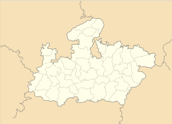
Hoshangabad District — is one of the districts of Madhya Pradesh state of India, and Hoshangabad town is the district headquarters.The district has an area 5408.23 km²., population 1,085,011 (2001 census), a 22% increase from 1991. Hoshangabad district is bounded by… … Wikipedia
Hoshangabad (Lok Sabha constituency) — Hoshangabad is a Lok Sabha constituency in Madhya Pradesh. Members of Parliament*1951: Syed Ahmed, Indian National Congress *1957: Bagdi Maganlal Radhakishan, Indian National Congress *1962: Hari Vishnu Kamath, Praja Socialist Party *1967: C. N.… … Wikipedia
HOSHANGABAD — (17), capital of a district of the same name in the Central Provinces, India, situated on the Nerbudda River, 40 m. SE. of Bhopal; is a military station, and has a considerable trade in cotton, grain, &c … The Nuttall Encyclopaedia
Pipariya, Hoshangabad — Infobox Indian Jurisdiction native name = Pipariya | type = city | latd = | longd = state name = Madhya Pradesh district = Hoshangabad leader title = leader name = altitude = population as of = 2001 population total = 41,307| population density … Wikipedia
Narmada River — View of Picturesque Narmada Bank Near Jabalpur Map of the Narmada River … Wikipedia
Mehara Gaon — city Coordinates Country India State Madhya Pradesh … Wikipedia
 Hoshangabad
 India
India
