Jhumri Tilaiya

Jhumri Tilaiya
Jhumri Tilaiya
Localidad de la India
Jhumri Tilaiya  झुमरी तलैया
Jhumri Tilaiya
झुमरी तलैया
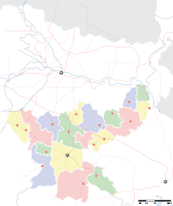
Ubicación de Jhumri Tilaiya en Jharkhand.
Ubicación de Jharkhand en India.
24°25′59″N 85°31′50″E / 24.43306, 85.53056Coordenadas: 24°25′59″N 85°31′50″E / 24.43306, 85.53056
Entidad Localidad
 • País Bandera de India India
 • Estado Jharkhand
 • Distrito Koderma
Altitud  
 • Media 398 msnm
Población (Est.2010[1] )  
 • Total 85.292 hab.
Huso horario IST UTC +5:30
PIN[2] 825409
Código de área 6534

Jhumri Tilaiya (en hindi: झुमरी तलैया ) es una localidad de la India, en el distrito de Koderma, estado de Jharkhand.

Contenido

Geografía

Se encuentra a una altitud de 398 msnm a 162 km de la capital estatal, Ranchi, en la zona horaria UTC +5:30.

Demografía

Según estimación 2010 contaba con una población de 85 292 habitantes.[1]

Referencias

Enlaces externos


Wikimedia foundation. 2010.

Игры ⚽ Нужно решить контрольную?

Mira otros diccionarios:

  • Jhumri Tilaiya — Infobox Indian Jurisdiction type = town native name = Jhumri Tilaiya other name = Jhumri Telaiya/Jhumri Talaiya nickname = state name = Jharkhand skyline = skyline caption = latd = 24.43 longd= 85.52 locator position = left area total = area… …   Wikipedia

  • Jumri Tilaiya — Original name in latin Jumri Tilaiy Name in other language Jhumri Telaiya, Jhumri Tellaya, Jumri Tilaiya, Jumri Tilaiy Kodarma State code IN Continent/City Asia/Kolkata longitude 24.4349 latitude 85.52951 altitude 398 Population 76341 Date 2012… …   Cities with a population over 1000 database

  • Dhanbad district — This article is about the district. For its eponymous headquarters, see Dhanbad. Dhanbad district धनबाद जिला Location of Dhanbad district in Jharkhand …   Wikipedia

  • Chatra district — This article is about the district. For its eponymous headquarters, see Chatra. Chatra district चतरा जिला Location of Chatra district in Jharkhand …   Wikipedia

  • Chauparan —   town   …   Wikipedia

  • North Chotanagpur division — (Hindi: उतरी छोटानागपुर प्रमण्डल) is one of the five divisions in the Indian state of Jharkhand. The division comprises the following districts: Bokaro district, Chatra district, Dhanbad district, Giridih district, Hazaribagh district, Koderma… …   Wikipedia

  • Dhanbad — This article is about the municipality in India. For its namesake district, see Dhanbad district. Dhanbad   city   …   Wikipedia

  • Koderma district — is one of the twenty two districts of Jharkhand state, India, and Koderma is the administrative headquarters of this district.Koderma district was created on 10 April, 1994, after being carved out of the original Hazaribagh District. Koderma is… …   Wikipedia

  • Dhanwar, Giridih — Dhanwar   city   …   Wikipedia

  • Chandaur —   city   …   Wikipedia

Compartir el artículo y extractos

Link directo
Do a right-click on the link above
and select “Copy Link”