- Kamiah (Idaho)
-
Kamiah Ciudad de los Estados Unidos 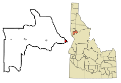
Ubicación en el condado de Lewis en Idaho
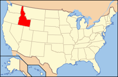
Ubicación de Idaho en EE. UU.Coordenadas: Entidad Ciudad • País  Estados Unidos
• Estado  Idaho
Idaho• Condado Idaho y Lewis Superficie • Total 3,0 km² • Tierra 2,9 km² • Agua (5,98%) 0,2 km² Altitud • Media 1379 msnm Población (2010) • Total 1.295 hab. • Densidad 431,67 hab/km² Huso horario Pacífico: UTC-8 • en verano UTC-7 Código ZIP 83536 Código de área 208 Kamiah es una ciudad ubicada en los condados de Idaho y Lewis en el estado estadounidense de Idaho.[1] En el año 2010 tenía una población de 1.295 habitantes y una densidad poblacional de 431,67 personas por km².[2]
Contenido
Geografía
Kamiah se encuentra ubicado en las coordenadas . Según la Oficina del Censo, la localidad tiene un área total de 3,0 km² (1,2 mi²), de la cual 2,9 km² (1,1 mi²) es tierra y 0,2 km² (0,1 mi²) (5.98%) es agua.[3]
Demografía
En el 2000[4] la renta per cápita promedia del hogar era de $21,793, y el ingreso promedio para una familia era de $33,424. En 2000 los hombres tenían un ingreso per cápita de $25,982 contra $19,688 para las mujeres. El ingreso per cápita para la localidad era de $14,111. Alrededor del 18.5% de la población estaba bajo el umbral de pobreza nacional.[5]
Referencias
- ↑ «U.S. Gazetteer: Censo de 2010» (en inglés). Oficina del Censo de los Estados Unidos (16 de febrero de 2011). Consultado el 11 de julio de 2011.
- ↑ «American FactFinder» (en inglés). Oficina del Censo de los Estados Unidos. Consultado el 11 de julio de 2011.
- ↑ «US Board on Geographic Names» (en inglés). Servicio Geológico de los Estados Unidos (25 de octubre de 2007). Consultado el 11 de julio de 2011.
- ↑ «Geographic Names Information System» (en inglés). Servicio Geológico de los Estados Unidos. Consultado el 11 de julio de 2011.
- ↑ «Encuentra un condado» (en inglés). Asociación Nacional de Condados (11 de julio de 2011). Consultado el 11 de julio de 2011.
Enlaces externos
 Portal:Idaho. Contenido relacionado con Idaho.
 Wikimedia Commons alberga contenido multimedia sobre Kamiah (Idaho). Commons
Categorías:- Ciudades de Idaho
- Localidades del condado de Idaho
- Localidades del condado de Lewis (Idaho)


Wikimedia foundation. 2010.