Keyport (Washington)

Keyport (Washington)
Keyport
Área no incorporada de los Estados Unidos
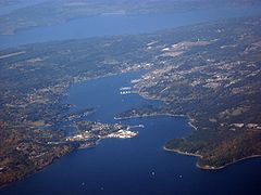
Aerial view of Keyport and Olympic Peninsula facing west from Port Orchard Bay.jpg
Vista aérea de Keyport
Keyport
Keyport
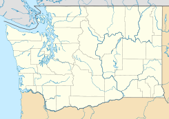
Ubicación en el condado de Kitsap en el estado de Washington
Map of USA WA.svg
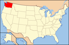
Ubicación de Washington en EE. UU.
47°42′7″N 122°37′10″O / 47.70194, -122.61944Coordenadas: 47°42′7″N 122°37′10″O / 47.70194, -122.61944
Entidad Área no incorporada
 • País Bandera de los Estados Unidos Estados Unidos
 • Estado Flag of Washington.svg Washington
 • Condado Kitsap
Huso horario Pacífico: UTC-8
 • en verano UTC-7

Keyport es un área no incorporada ubicada en el condado de Kitsap en el estado estadounidense de Washington.

Geografía

Keyport se encuentra ubicado en las coordenadas 47°42′7″N 122°37′10″O / 47.70194, -122.61944Coordenadas: 47°42′7″N 122°37′10″O / 47.70194, -122.61944.[1]

Referencias

  1. «American FactFinder» (en inglés). Oficina del Censo de los Estados Unidos. Consultado el 11 de julio de 2011.

Enlaces externos


Wikimedia foundation. 2010.

Игры ⚽ Поможем написать реферат

Mira otros diccionarios:

  • Keyport, Washington — Keyport is an unincorporated community in Kitsap County, Washington, United States. The community is located at the eastern terminus of State Route 308 on the Kitsap Peninsula, convert|3.42|mi|km east of Subase Bangor. Keyport s ZIP Code, 98345,… …   Wikipedia

  • Keyport — is the name of some places in the United States of America: *Keyport, New Jersey *Keyport, Washington …   Wikipedia

  • Keyport — Para otros usos de este término, véase Keyport (Washington). Keyport Borough de los Estados Unidos …   Wikipedia Español

  • Washington State Route 308 — infobox WA State Route type=WA route=308 sec=567 parent=3 parent type=WA length mi=3.42 length ref=cite web|author=Washington State Department of Transportation|url=http://www.wsdot.wa.gov/mapsdata/tdo/PDF and ZIP… …   Wikipedia

  • Kitsap County, Washington — Infobox U.S. County county = Kitsap County state = Washington map size = 225 founded = January 16, 1857 seat = Port Orchard | area total sq mi =566 area land sq mi =396 area water sq mi =170 area percentage = 30.04% census yr = 2000 pop = 231969… …   Wikipedia

  • List of unincorporated communities in Washington — This is a list of unincorporated communities in the U.S. state of Washington which are not incorporated municipalities. Incorporated municipalities in the state are listed separately in a list of cities and list of towns. Contents 1 Census… …   Wikipedia

  • Chico, Washington — Chico   CDP   …   Wikipedia

  • Olalla, Washington — This article is about the community in Washington. For the community in British Columbia, see Olalla, British Columbia. Olalla   Unincorporated community   …   Wikipedia

  • Manchester, Washington —   CDP   Locat …   Wikipedia

  • Navy Yard City, Washington —   CDP   …   Wikipedia

Compartir el artículo y extractos

Link directo
Do a right-click on the link above
and select “Copy Link”