Kiona, Washington — Kiona is an unincorporated community in Benton County, Washington, United States. Kiona and Benton City share a school district (commonly called Ki Be ).HistoryIn 1888, the Northern Pacific Railroad built a new station in the western part of… … Wikipedia
Kiona-Benton City School District — The Kiona Benton City School District is a public school district in Washington State.choolsThe Ki Be School District, as it is informally known, includes three schools: KiBe Elementary School (mascot Teddy Bears), KiBe Middle School (Cubs) and… … Wikipedia
Washington State Route 224 — Infobox WA State Route type=State route=224 sec= parent type=WA parent=22 length mi=10.15 length ref=cite web|author=Washington State Department of Transportation|url=http://www.wsdot.wa.gov/mapsdata/tdo/PDF and ZIP… … Wikipedia
Washington State Route 225 — Infobox WA State Route type=State route=225 sec= parent type=WA parent=22 length mi=11.12 length ref=cite web|author=Washington State Department of Transportation|url=http://www.wsdot.wa.gov/mapsdata/tdo/PDF and ZIP… … Wikipedia
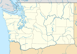
Benton County, Washington — Location in the state of Washington … Wikipedia
Benton City, Washington — Infobox Settlement official name = Benton City, Washington settlement type = City nickname = motto = imagesize = image caption = image imagesize = image caption = image mapsize = 250px map caption = Location of Benton City, Washington mapsize1 =… … Wikipedia
List of unincorporated communities in Washington — This is a list of unincorporated communities in the U.S. state of Washington which are not incorporated municipalities. Incorporated municipalities in the state are listed separately in a list of cities and list of towns. Contents 1 Census… … Wikipedia
A.C. Davis High School (Washington) — Davis High School Established 1884 Type IB World School high school Principal Ben Ramirez Faculty 100 Students 2,000 … Wikipedia
List of high schools in Washington — This is a list of high schools in the state of Washington.Adams County*Lind Junior Senior High School, Lind *Othello High School, Othello *Ritzville High School, Ritzville * [http://www.tucna.wednet.edu/default.aspx Washtucna High School,… … Wikipedia
Condado de Benton (Washington) — Para otros usos de este término, véase Condado de Benton. Condado de Benton Condados de Washington Mapa … Wikipedia Español
 Kiona
Kiona
 Estados Unidos
 Washington
 Portal:Washington. Contenido relacionado con Washington.
 Wikimedia Commons alberga contenido multimedia sobre Kiona (Washington). Commons
