Looperskapelle — 51°43′36″N 3°51′52″E / 51.72667, 3.86444 … Wikipédia en Français
Looperskapelle — Dutch town locator maps mun town caption = Looperskapelle in the municipality of Schouwen Duiveland.Looperskapelle (coord|51|44|N|3|52|E|type:city(100)) is a hamlet in the Dutch province of Zeeland. It is a part of the municipality of Schouwen… … Wikipedia
Liste aller niederländischen Gemeinden A–L — In diese Liste werden alle Gemeinden, die auf dem Gebiet der jetzigen Niederlande bestehen oder bestanden haben, aufgenommen. Die Liste beginnt im Jahr 1805/10. Vor 1830 können die Angaben unvollständig sein. Kleinere Grenzkorrekturen oder… … Deutsch Wikipedia
Duivendijke — Duiveland Ancienne commune des Pays Bas Histoire Administration Pays Pays Bas … Wikipédia en Français
Schouwen-Duiveland — Héraldique … Wikipédia en Français
Schouwen-duiveland — Schouwen Duiveland … Wikipédia en Français
Schouwen-Duiveland — Infobox Settlement official name = Schouwen Duiveland mapsize = 280px subdivision type = Country subdivision name = Netherlands subdivision type1 = Province subdivision name1 = Zeeland area footnotes = (2006) area total km2 = 488.94 area land km2 … Wikipedia
Kapelle (disambiguation) — Kapelle is the name of several locations in the Netherlands and Belgium:In Belgium: * Kapelle op den Bos, a town in Flemish Brabant * Kapellen, Belgium, a town in the Belgian province of Antwerp is a homonym * Westkapelle, a village in West… … Wikipedia
Kapelle (Schouwen-Duiveland) — Kapelle (formerly Capelle) is a hamlet in the Dutch province of Zeeland. It is located on the island of Schouwen Duiveland, about 2 km west of Nieuwerkerk.Until 1813, the hamlet was part of the separate municipality of Capelle en Botland. In 1953 … Wikipedia
Duivendijke — is a former village in the Dutch province of Zeeland. It was located about 2km southwest of Brouwershaven on the island of Schouwen Duiveland. The village had a church, which was demolished before the middle of the 18th century. The first bishop… … Wikipedia
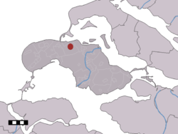


 Looperskapelle
 Países Bajos