Marrowstone (Washington)

Marrowstone (Washington)
Marrowstone
Lugar designado por el censo de los Estados Unidos
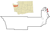
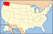
Ubicación en el condado de Jefferson en el estado de Washington Ubicación de Washington en EE. UU.
Ubicación en el condado de Jefferson en el estado de Washington
Map of USA WA.svg
Ubicación de Washington en EE. UU.
Entidad Lugar designado por el censo
 • País Bandera de los Estados Unidos Estados Unidos
 • Estado Flag of Washington.svg Washington
 • Condado Jefferson
Superficie  
 • Total 16.4 km²
 • Tierra 16.4 km²
 • Agua 0.0 km²
Altitud  
 • Media 5 msnm
Población (2000)  
 • Total 837 hab.
 • Densidad 51,1 hab/km²
Huso horario Pacífico: UTC-8
 • en verano UTC-7
Código de área 360

Marrowstone es un lugar designado por el censo ubicado en el condado de Jefferson en el estado estadounidense de Washington. En el año 2000 tenía una población de 837 habitantes y una densidad poblacional de 51,1 personas por km².[1]

Contenido

Geografía

Marrowstone se encuentra ubicado en las coordenadas 48°3′30″N 122°41′17″O / 48.05833, -122.68806Coordenadas: 48°3′30″N 122°41′17″O / 48.05833, -122.68806.[2]

Demografía

Según la Oficina del Censo en 2000 los ingresos medios por hogar en la localidad eran de $38.812, y los ingresos medios por familia eran $41.607. Los hombres tenían unos ingresos medios de $36.250 frente a los $26.607 para las mujeres. La renta per cápita para la localidad era de $22.028. Alrededor del 4,0% de la población estaban por debajo del umbral de pobreza.[3]

Referencias

  1. «Encuentra un condado» (en inglés). Asociación Nacional de Condados (11 de julio de 2011). Consultado el 11 de julio de 2011.
  2. «American FactFinder» (en inglés). Oficina del Censo de los Estados Unidos. Consultado el 11 de julio de 2011.
  3. «U.S. Gazetteer: Censo de 2010» (en inglés). Oficina del Censo de los Estados Unidos (16 de febrero de 2011). Consultado el 11 de julio de 2011.

Enlaces externos


Wikimedia foundation. 2010.

Игры ⚽ Нужна курсовая?

Mira otros diccionarios:

  • Marrowstone, Washington —   CDP   …   Wikipedia

  • Washington locations by per capita income — Washington is the twelfth richest state in the United States of America, with a per capita income of $22,973 (2000) and a personal per capita income of $33,332 (2003).Washington counties ranked by per capita incomeThere are thirty nine counties… …   Wikipedia

  • Marrowstone Light — Location Fort Flagler, Washington Coordinates 48°06′06″N …   Wikipedia

  • Marrowstone — Marrowstone, WA U.S. Census Designated Place in Washington Population (2000): 837 Housing Units (2000): 528 Land area (2000): 6.323745 sq. miles (16.378424 sq. km) Water area (2000): 0.000000 sq. miles (0.000000 sq. km) Total area (2000):… …   StarDict's U.S. Gazetteer Places

  • Marrowstone, WA — U.S. Census Designated Place in Washington Population (2000): 837 Housing Units (2000): 528 Land area (2000): 6.323745 sq. miles (16.378424 sq. km) Water area (2000): 0.000000 sq. miles (0.000000 sq. km) Total area (2000): 6.323745 sq. miles… …   StarDict's U.S. Gazetteer Places

  • Washington State Route 116 — Infobox WA State Route|parent type=U.S.|parent=101|route=116|sec=219 length mi=9.38|length round=2|type=State dir1=West|dir2=East from= to=Fort Flagler State Park previous type=WA previous route=115 next type=WA next route=117State Route 116 is a …   Wikipedia

  • Jefferson County, Washington — Location in the state of Washington …   Wikipedia

  • National Register of Historic Places listings in Jefferson County, Washington — List of entries on the National Register of Historic Places in Jefferson County, Washington See also National Register of Historic Places listings in Washington This National Park Service list is complete through NPS recent listings posted… …   Wikipedia

  • Indian Island, Washington — Indian Island is an unincorporated community in Jefferson County, Washington, United States. It is located between Port Townsend Bay and Kilisut Harbor. Parts also border on Oak Bay and Scow Bay. Until the construction of the Port Townsend Ship… …   Wikipedia

  • Chimacum, Washington — Chimacum is an unincorporated community in eastern Jefferson County, Washington, United States. It lies on the Olympic Peninsula. It was named after the Chimakum (also spelled Chemakum or Chimacum) group of Native Americans that lived there until …   Wikipedia

Compartir el artículo y extractos

Link directo
Do a right-click on the link above
and select “Copy Link”