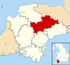
Mid Devon

Mid Devon
Mid Devon
Distrito del Reino Unido
Mid Devon UK locator map.svg
Ubicación en el condado de Devon.
Entidad Distrito
 • País Bandera del Reino Unido Reino Unido
 • Nación constitutiva Inglaterra
 • Región Suroeste de Inglaterra
 • Condado Devon
Superficie  
 • Total 912.93 km²
Población (2001)  
 • Total 69 774 hab.
 • Densidad 76,43 hab/km²

Mid Devon es un distrito no metropolitano del condado de Devon (Inglaterra). Tiene una superficie de 912,93 km². Según el censo de 2001, Mid Devon estaba habitado por 69 774 personas y su densidad de población era de 76,43 hab/km².[1]

Referencias

  1. «Find statistics for an area» (en inglés). Office for National Statistics. Consultado el 13 de agosto de 2011.

Wikimedia foundation. 2010.

Игры ⚽ Поможем написать курсовую

Mira otros diccionarios:

  • Mid Devon — District Lage in Devon Status District Region South West England Verw.grafschaft Devon Verwal …   Deutsch Wikipedia

  • Mid Devon — Coordinates: 50°54′00″N 3°29′24″W / 50.900°N 3.490°W / 50.900; 3.490 …   Wikipedia

  • Mid Devon — 50° 54′ 00″ N 3° 29′ 24″ W / 50.900, 3.490 …   Wikipédia en Français

  • Mid Devon — ▪ district, England, United Kingdom       district, administrative and historic county of Devon, southwestern England, located between the bleak moorlands of Exmoor and Dartmoor. Mid Devon is a heavily dissected interior plateau 400 to 800 feet… …   Universalium

  • Mid Devon local elections — Mid Devon District Council in Devon, England is elected every four years. Since the last boundary changes in 2003, 42 councillors have been elected from 24 wards.[1] Contents 1 Political control 2 Council elections …   Wikipedia

  • Bickleigh, Mid Devon — Bickleigh is a village and civil parish in the Mid Devon district of Devon, England, about four miles south of Tiverton. It is in the former hundred of Hayridge. According to the 2001 census it had a population of 239.The village lies in the… …   Wikipedia

  • Appledore, Mid Devon — See Appledore for other places with the same name. infobox UK place latitude= 50.9206 longitude= 3.3302 country = England official name= Appledore population= shire county = Devon shire district= Mid Devon region= South West England os grid… …   Wikipedia

  • Woolfardisworthy, Mid Devon — Woolfardisworthy is a village in Mid Devon.It is situated about 9km north of Crediton.There is another (larger) village of the same name in the Torridge district of north Devon …   Wikipedia

  • Devon and Cornwall Police — Badge of the Devon and Cornwall Police. Motto In Auxilium Omnium …   Wikipedia

  • Devon County Council — Type Type Unicameral of county council …   Wikipedia

Compartir el artículo y extractos

Link directo
Do a right-click on the link above
and select “Copy Link”