- Mukatsar
-
Mukatsar Localidad de la India Ubicación de Mukatsar en Punyab.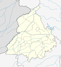
 Mukatsar
ਸ਼੍ਰੀ ਮੁਕੱਤਸਰ ਸਾਹਿਬCoordenadas: Entidad Localidad • País  India
India• Estado Punyab • Distrito Mukatsar Altitud • Media 203 msnm Población (Est.2010[1] ) • Total 72.966 hab. Huso horario IST UTC +5:30 PIN[2] 152026 Código de área 1633 Mukatsar (en punyabí: ਸ਼੍ਰੀ ਮੁਕੱਤਸਰ ਸਾਹਿਬ ) es una ciudad de la India, centro administrativo del distrito de Mukatsar, en el estado de Punyab.
Contenido
Geografía
Se encuentra a una altitud de 203 msnm a 277 km de la capital estatal, Chandigarh, en la zona horaria UTC +5:30.
Demografía
Según estimación 2010 contaba con una población de 72 966 habitantes.[1]
Referencias
Enlaces externos
Categoría:- Localidades de Punyab

Wikimedia foundation. 2010.