North Patchogue

North Patchogue
North Patchogue
Lugar designado por el censo de los Estados Unidos
North Patchogue
North Patchogue
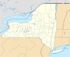
Ubicación en el condado de Suffolk y en el estado de Nueva York
40°47′3″N 73°1′23″O / 40.78417, -73.02306Coordenadas: 40°47′3″N 73°1′23″O / 40.78417, -73.02306
Entidad Lugar designado por el censo
 • País Bandera de los Estados Unidos Estados Unidos
 • Estado Flag of New York.svg Nueva York
 • Condado Suffolk
 • Pueblo Brookhaven
Superficie  
 • Total 5,7 km²
 • Tierra 5,6 km²
 • Agua 0,1 km²
Altitud  
 • Media 15 msnm
Población (2000)  
 • Total 7.825 hab.
 • Densidad 1,416.9 hab/km²
Huso horario Este: UTC-5
 • en verano UTC-4
Código postal 11772
Prefijo telefónico 631

North Patchogue es un lugar designado por el censo (o aldea) ubicado en el condado de Suffolk en el estado estadounidense de Nueva York. En el año 2000 tenía una población de 7,825 habitantes y una densidad poblacional de 1,416.9 personas por km².

Contenido

Geografía

North Patchogue se encuentra ubicada en las coordenadas 40°47′3″N 73°1′23″O / 40.78417, -73.02306. Según la Oficina del Censo, la ciudad tiene un área total de 5,7 km² (2,2 mi²), de la cual 5,6 km² (2,2 mi²) es tierra y 0,1 km² (0 mi²) (2.29%) es agua.

Demografía

Según la Oficina del Censo en 2000 los ingresos medios por hogar en la localidad eran de $61,145, y los ingresos medios por familia eran $65,117. Los hombres tenían unos ingresos medios de $44,302 frente a los $31,724 para las mujeres. La renta per cápita para la localidad era de $23,719. Alrededor del 3.7% de la población estaban por debajo del umbral de pobreza.[1]

Referencias

  1. «U.S. Gazetteer: Censo de 2010» (en inglés). Oficina del Censo de los Estados Unidos (16 de febrero de 2011). Consultado el 11 de julio de 2011.

Enlaces externos


Wikimedia foundation. 2010.

Игры ⚽ Нужен реферат?

Mira otros diccionarios:

  • North Patchogue — North Patchogue, NY U.S. Census Designated Place in New York Population (2000): 7825 Housing Units (2000): 2781 Land area (2000): 2.132342 sq. miles (5.522739 sq. km) Water area (2000): 0.049818 sq. miles (0.129029 sq. km) Total area (2000):… …   StarDict's U.S. Gazetteer Places

  • North Patchogue, NY — U.S. Census Designated Place in New York Population (2000): 7825 Housing Units (2000): 2781 Land area (2000): 2.132342 sq. miles (5.522739 sq. km) Water area (2000): 0.049818 sq. miles (0.129029 sq. km) Total area (2000): 2.182160 sq. miles… …   StarDict's U.S. Gazetteer Places

  • North Patchogue — Original name in latin North Patchogue Name in other language State code US Continent/City America/New York longitude 40.78704 latitude 73.009 altitude 17 Population 7246 Date 2011 05 14 …   Cities with a population over 1000 database

  • North Patchogue, New York —   CDP   U.S. Census Map Coordinate …   Wikipedia

  • North Bellport, New York —   CDP   U.S. Census Map …   Wikipedia

  • Patchogue, New York — Infobox Settlement official name = Patchogue, New York settlement type = Village nickname = motto = imagesize = image caption = image pushpin pushpin label position = none pushpin map caption =Location within the state of New York pushpin mapsize …   Wikipedia

  • Patchogue (LIRR station) — Infobox Station name=Patchogue style=LIRR image size= image caption=Patchogue Station from the entrance at Division Street Cedar Avenue; December 26, 2007 address=Division Street between West Avenue South Ocean Avenue Patchogue, New York,… …   Wikipedia

  • Patchogue — Wohngebiet der Patchogue und benachbarter Stämme um 1600 Die Patchogue waren einer von 14 Algonkin sprechenden Indianerstämmen auf Long Island im US Bundesstaat New York und lebten zu Beginn des 17. Jahrhunderts an der Great South Bay an der… …   Deutsch Wikipedia

  • North Fork, Suffolk County, New York — The North Fork is a 30 mile long peninsula in the northeast part of Suffolk County, New York, roughly parallel with an even longer peninsula known as the South Fork. Although the peninsula begins east of Riverhead hamlet, the term North Fork can… …   Wikipedia

  • U.S. Post Office (Patchogue, New York) — Infobox nrhp | name = US Post Office Patchogue nrhp type = caption = The front of the Patchogue Post Office location = Patchogue, NY nearest city = lat degrees = 40 lat minutes = 45 lat seconds = 55 lat direction = N long degrees = 73 long… …   Wikipedia

Compartir el artículo y extractos

Link directo
Do a right-click on the link above
and select “Copy Link”