Ongole

Ongole
Ongole
Localidad de la India
Ongole  অনগোলে
Ongole
অনগোলে
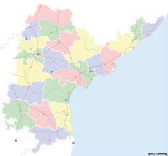
Ubicación de Ongole en Andhra Pradesh.
Ubicación de Andhra Pradesh en India.
15°30′12″N 80°02′44″E / 15.50333, 80.04556Coordenadas: 15°30′12″N 80°02′44″E / 15.50333, 80.04556
Entidad Localidad
 • País Bandera de India India
 • Estado Andhra Pradesh
 • Distrito Prakasam
Altitud  
 • Media 26 msnm
Población (Est.2010[1] )  
 • Total 208.044 hab.
Huso horario IST UTC +5:30
PIN[2] 523001/2
Código de área (91)8592

Ongole (en hindi: অনগোলে ) es una localidad de la India, centro administrativo del distrito de Prakasam, estado de Andhra Pradesh.

Contenido

Geografía

Se encuentra a una altitud de 26 msnm a 321 km de la capital estatal, Hyderabad, en la zona horaria UTC +5:30.

Demografía

Según estimación 2010 contaba con una población de 208 044 habitantes.[1]

Referencias

Enlaces externos


Wikimedia foundation. 2010.

Игры ⚽ Поможем сделать НИР

Mira otros diccionarios:

  • Ongole — ఒంగోలు Ongole   city   …   Wikipedia

  • Ongole — Original name in latin Ongole Name in other language Ongole, anagole, ao en ge lai, awngl, ongole, ongolu, onkol, Онголе State code IN Continent/City Asia/Kolkata longitude 15.50642 latitude 80.04867 altitude 19 Population 172872 Date 2013 02 08 …   Cities with a population over 1000 database

  • ongole — ˈänˌgōl, ˈäŋˌ noun Usage: usually capitalized Etymology: from Ongole, town in southern India : nellfore …   Useful english dictionary

  • Ongole (Lok Sabha constituency) — Ongole Lok Sabha constituency (Telugu: ఒంగోలు లోక సభ నియోజకవర్గం) is one of the 42 Lok Sabha (Lower House of the Parliament) constituencies in Andhra Pradesh state in southern India.[1] Contents 1 Assembly segments 2 Members of Parliament …   Wikipedia

  • ongole — on·gole …   English syllables

  • Prakasam district — This article is about the Prakasam district. For the famous leader, see Tanguturi Prakasam. Prakasam ప్రకాశం   district   …   Wikipedia

  • Lakkavaram — Infobox Indian Jurisdiction native name = Lakkavaram | type = Village | latd = 15.698285 | longd = 79.794474 locator position = right | state name = Andhra Pradesh district = Prakasam Mandal = Talluru population as of = 2008 population total =… …   Wikipedia

  • Dhenuva Konda —   village   …   Wikipedia

  • Manduvavaripalem —   village   …   Wikipedia

  • Marripudi — is a village(mandal) in the state of Andhra Pradesh, India. Its distance is 50 kilometres from Ongole, the district headquarters of Prakasam District, and is 10 kilometres away from Podili the nearest Taluk. It is situated off the Ongole Podili… …   Wikipedia

Compartir el artículo y extractos

Link directo
Do a right-click on the link above
and select “Copy Link”