Orchards (Washington)

Orchards (Washington)
Orchards
Lugar designado por el censo de los Estados Unidos
Ubicación en el condado de Clark en el estado de Washington Ubicación de Washington en EE. UU.
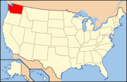
Ubicación en el condado de Clark en el estado de Washington
Map of USA WA.svg
Ubicación de Washington en EE. UU.
Entidad Lugar designado por el censo
 • País Bandera de los Estados Unidos Estados Unidos
 • Estado Flag of Washington.svg Washington
 • Condado Clark
Superficie  
 • Total 17.8 km²
 • Tierra 17.8 km²
 • Agua 0.0 km²
Altitud  
 • Media 69 msnm
Población (2000)  
 • Total 17,852 hab.
 • Densidad 1004,4 hab/km²
Huso horario Pacífico: UTC-8
 • en verano UTC-7
Código ZIP 98662
Código de área 360

Orchards es un lugar designado por el censo ubicado en el condado de Clark en el estado estadounidense de Washington. En el año 2000 tenía una población de 17.852 habitantes y una densidad poblacional de 1004,4 personas por km².[1]

Contenido

Geografía

Orchards se encuentra ubicado en las coordenadas 45°41′2″N 122°31′45″O / 45.68389, -122.52917Coordenadas: 45°41′2″N 122°31′45″O / 45.68389, -122.52917.[2]

Demografía

Según la Oficina del Censo en 2000 los ingresos medios por hogar en la localidad eran de $49.216, y los ingresos medios por familia eran $50.330. Los hombres tenían unos ingresos medios de $37.716 frente a los $26.576 para las mujeres. La renta per cápita para la localidad era de $17.866. Alrededor del 6,7% de la población estaban por debajo del umbral de pobreza.[3]

Referencias

  1. «Encuentra un condado» (en inglés). Asociación Nacional de Condados (11 de julio de 2011). Consultado el 11 de julio de 2011.
  2. «American FactFinder» (en inglés). Oficina del Censo de los Estados Unidos. Consultado el 11 de julio de 2011.
  3. «U.S. Gazetteer: Censo de 2010» (en inglés). Oficina del Censo de los Estados Unidos (16 de febrero de 2011). Consultado el 11 de julio de 2011.

Enlaces externos


Wikimedia foundation. 2010.

Игры ⚽ Поможем решить контрольную работу

Mira otros diccionarios:

  • Orchards, Washington —   CDP   Location of O …   Wikipedia

  • Washington locations by per capita income — Washington is the twelfth richest state in the United States of America, with a per capita income of $22,973 (2000) and a personal per capita income of $33,332 (2003).Washington counties ranked by per capita incomeThere are thirty nine counties… …   Wikipedia

  • Washington (state) — Washington state redirects here. For the university, see Washington State University. State of Washington …   Wikipedia

  • Orchards — Orchards, WA U.S. Census Designated Place in Washington Population (2000): 17852 Housing Units (2000): 6175 Land area (2000): 6.862420 sq. miles (17.773585 sq. km) Water area (2000): 0.000000 sq. miles (0.000000 sq. km) Total area (2000):… …   StarDict's U.S. Gazetteer Places

  • Orchards, WA — U.S. Census Designated Place in Washington Population (2000): 17852 Housing Units (2000): 6175 Land area (2000): 6.862420 sq. miles (17.773585 sq. km) Water area (2000): 0.000000 sq. miles (0.000000 sq. km) Total area (2000): 6.862420 sq. miles… …   StarDict's U.S. Gazetteer Places

  • Orchards Elementary School — is an elementary school located in Vancouver, Washington and is part of Evergreen Public Schools. It was recently remodeled in 2006. The school holds many students from kindergarten to fifth grade. The principal is Mrs. Vinh Nguyen. There are two …   Wikipedia

  • Washington — US state Name = Washington Fullname = State of Washington Flaglink = Flag of Washington Nickname = The Evergreen State Motto = Alki (Chinook Wawa: Eventually, or By and by [ [http://www1.leg.wa.gov/Legislature/StateSymbols/ State Symbols ] ]… …   Wikipedia

  • Washington Township, Bergen County, New Jersey — Infobox Settlement official name = Township of Washington settlement type = Township nickname = Washington Township motto = imagesize = image caption = image mapsize = 250x200px map caption = Map highlighting Washington Township s location within …   Wikipedia

  • Washington County, Oregon — Infobox U.S. County county = Washington County state = Oregon map size = 250 founded = September 3, 1849 seat = Hillsboro | area total sq mi =726 area land sq mi =724 area water sq mi =3 area percentage = 0.36% census yr = 2000 pop = 445342… …   Wikipedia

  • Washington Parks Bicycle Route — The Adventure Cycling Association Washington Parks Bicycle Route is a double loop rather than a point to point route that showcases the diversity of Washington State, from its ocean and sound views in the west to the fertile orchards of the… …   Wikipedia

Compartir el artículo y extractos

Link directo
Do a right-click on the link above
and select “Copy Link”