Shandaken

Shandaken
Shandaken
Pueblo de los Estados Unidos
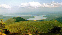
Ashokan Reservoir from Wittenberg.jpg
Reserva Ashokan
Shandaken
Shandaken
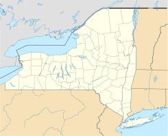
Ubicación en el condado de Ulster y en el estado de Nueva York
Map of USA NY.svg
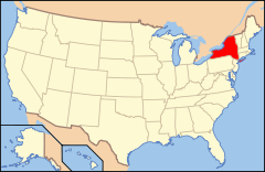
Ubicación de Nueva York en EE. UU.
42°6′40″N 74°22′55″O / 42.11111, -74.38194Coordenadas: 42°6′40″N 74°22′55″O / 42.11111, -74.38194
Entidad Pueblo
 • País Bandera de los Estados Unidos Estados Unidos
 • Estado Flag of New York.svg Nueva York
 • Condado Ulster
Superficie  
 • Total 310,4 km²
 • Tierra 310,4 km²
 • Agua (0%) 0 km²
Altitud  
 • Media 411 msnm
Población (2000)  
 • Total 3.235 hab.
 • Densidad 10 hab/km²
Huso horario Este: UTC-5
 • en verano UTC-4
Código postal 12480
Código de área 845
Sitio web oficial

Shandaken es un pueblo ubicado en el condado de Ulster en el estado estadounidense de Nueva York. En el año 2000 tenía una población de 3,235 habitantes y una densidad poblacional de 10 personas por km².

Contenido

Geografía

Shandaken se encuentra ubicado en las coordenadas 42°6′40″N 74°22′55″O / 42.11111, -74.38194. Según la Oficina del Censo, la ciudad tiene un área total de 310,4 km² (119,8 mi²), de la cual 310,4 km² (119,8 mi²) es tierra y 0 km² (0 mi²) (0%) es agua.

Demografía

Según la Oficina del Censo en 2000 los ingresos medios por hogar en la localidad eran de [[dólar de Estados Unidos|$]31,566, y los ingresos medios por familia eran $40,927. Los hombres tenían unos ingresos medios de $38,854 frente a los $23,063 para las mujeres. La renta per cápita para la localidad era de $21,121. Alrededor del 12.3% de la población estaban por debajo del umbral de pobreza.[1]

Referencias

  1. «U.S. Gazetteer: Censo de 2010» (en inglés). Oficina del Censo de los Estados Unidos (16 de febrero de 2011). Consultado el 11 de julio de 2011.

Enlaces externos


Wikimedia foundation. 2010.

Игры ⚽ Поможем написать курсовую

Mira otros diccionarios:

  • Shandaken, New York — Infobox Settlement official name = Shandaken, New York settlement type = Town nickname = motto = imagesize = image caption = image |pushpin pushpin label position = pushpin map caption =Location within the state of New York pushpin mapsize =… …   Wikipedia

  • Shandaken Tunnel — The Shandaken Tunnel is an underground tunnel in Eastern New York State, part of the New York City water supply system. It was constructed between 1917 and 1924. The aqueduct starts in Gilboa, New York at the Schoharie Reservoir, which is in the… …   Wikipedia

  • Shandaken Railroad Station — This station, MP 32.1, was located where the site of the old Allaben station. The old Allaben station was a big masonry building that served the village of Allaben. It was torn down in 1899, and replaced with a new pre fabricated station. This… …   Wikipedia

  • 12480 — Shandaken, Ny (Miscellaneous » ZIP Codes) …   Abbreviations dictionary

  • New York State Route 42 — NY 42 redirects here. NY 42 may also refer to New York s 42nd congressional district. This article is about the current alignment of NY 42. For the former alignment of NY 42 in the Southern Tier, see New York State Route 42 (1920s–1930). NYS… …   Wikipedia

  • District School No. 14 — U.S. National Register of Historic Places …   Wikipedia

  • New York State Route 28 — NY 28 redirects here. NY 28 may also refer to New York s 28th congressional district. NYS Route 28 …   Wikipedia

  • Neversink River — Coordinates: 41°21′26″N 74°41′43″W / 41.35722°N 74.69528°W / 41.35722; 74.69528 …   Wikipedia

  • Chichester, New York — The hamlet of Chichester, New York, formerly referred to as Chichesterville, is one of the northernmost communities in the town of Shandaken, New York, being right next to the borderline between Ulster County and Greene County. The hamlet of… …   Wikipedia

  • Deep Notch — View north into notch Elevation 1,900 feet (580 m) …   Wikipedia

Compartir el artículo y extractos

Link directo
Do a right-click on the link above
and select “Copy Link”