Singac

Singac
Singac
Lugar designado por el censo de los Estados Unidos
Singac
Singac
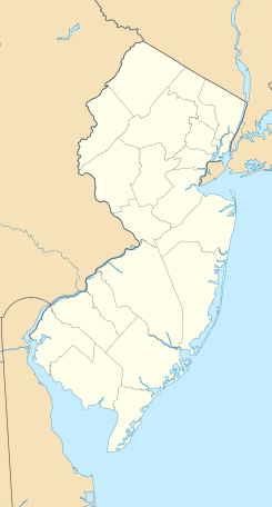
Ubicación en el condado de Passaic en Nueva Jersey
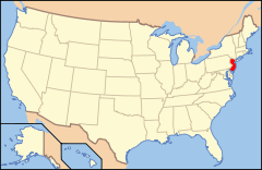
Ubicación de Nueva Jersey en EE. UU.
40°53′12.07″N 74°14′27.34″O / 40.8866861, -74.2409278Coordenadas: 40°53′12.07″N 74°14′27.34″O / 40.8866861, -74.2409278
Entidad Lugar designado por el censo
 • País Bandera de los Estados Unidos Estados Unidos
 • Estado Bandera de Nueva Jersey Nueva Jersey
 • Condado Passaic
Fundación 31 de marzo de 2010
Altitud  
 • Media 44 msnm
Población (2010)  
 • Total 3.618 hab.
Huso horario Este: UTC-5
 • en verano UTC-4
Código ZIP 07424

Singac es un lugar designado por el censo ubicado en el condado de Passaic en el estado estadounidense de Nueva Jersey. En el año 2010 tenía una población de 3,618 habitantes.[1]

Geografía

Singac se encuentra ubicado en las coordenadas 40°53′12.07″N 74°14′27.34″O / 40.8866861, -74.2409278.[2]

Referencias

  1. «Encuentra un condado» (en inglés). Asociación Nacional de Condados (11 de julio de 2011). Consultado el 11 de julio de 2011.
  2. «American FactFinder» (en inglés). Oficina del Censo de los Estados Unidos. Consultado el 11 de julio de 2011.

Enlaces externos


Wikimedia foundation. 2010.

Игры ⚽ Поможем решить контрольную работу

Mira otros diccionarios:

  • Singac — Original name in latin Singac Name in other language State code US Continent/City America/New York longitude 40.88677 latitude 74.24098 altitude 52 Population 3618 Date 2011 05 14 …   Cities with a population over 1000 database

  • Montclair-Boonton Line —   Montclair Boonton Line …   Wikipedia

  • Little Falls, New Jersey — Infobox Settlement official name = Little Falls, New Jersey settlement type = Township nickname = motto = imagesize = image caption = image mapsize = 250x200px map caption = Map of Little Falls Township in Passaic County. Inset: Location of… …   Wikipedia

  • Passaic River — Geobox River name = Passaic River native name = other name = other name1 = image size = 300 image caption = The Passaic River in Essex County country = USA country1 = state = New Jersey state1 = region type = Counties region = Essex region1 =… …   Wikipedia

  • Newark-Pompton Turnpike — Route information Existed: 1806 – present Highway system New Jersey State Highway Routes Interstate and US The Newark Pompton Turnpike (now known in …   Wikipedia

  • List of turnpikes in New Jersey — For the turnpike built in the 20th century, see New Jersey Turnpike. This is a list of turnpike roads, built and operated by private companies in exchange for the privilege of collecting a toll, in the U.S. state of New Jersey, mainly in the 19th …   Wikipedia

  • 29 Diner — The 29 Diner is a diner in Fairfax, Virginia located near the intersection of Route 29 (Lee Highway) Virginia State Route 123.HistoryThe 29 Diner opened on July 20, 1947. It was built by the Mountain View Diner Company of Singac, New Jersey. In… …   Wikipedia

  • Diner (restaurante) — Saltar a navegación, búsqueda Un diner en Freehold Borough, Nueva Jersey Un diner es un restaurante incluido en un edificio en forma de bloque prefabricado muy típico Norte América, especialmente en Nueva Jersey, Long Island, así como en otras á …   Wikipedia Español

  • New York and Greenwood Lake Railway (1878–1943) — New York Greenwood Lake Service of the Erie Railroad (former) Legend …   Wikipedia

  • Condado de Passaic — Condado de los Estados Unidos Centro de Paterson …   Wikipedia Español

Compartir el artículo y extractos

Link directo
Do a right-click on the link above
and select “Copy Link”