Smithfield (Rhode Island)

Smithfield (Rhode Island)
Smithfield
Pueblo de los Estados Unidos
Smithfield
Smithfield
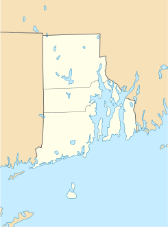
Ubicación en el condado de Providence y en el estado de Rhode Island
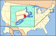
Map of USA RI.svg
Ubicación de Rhode Island en EE. UU.
41°55′19″N 71°32′58″O / 41.92194, -71.54944Coordenadas: 41°55′19″N 71°32′58″O / 41.92194, -71.54944
Entidad Pueblo
 • País Bandera de los Estados Unidos Estados Unidos
 • Estado Flag of Rhode Island.svg Rhode Island
 • Condado Providence
Fundación Incorporado: 1730
Superficie  
 • Total 71,9 km²
 • Tierra 68,9 km²
 • Agua (4,3%) 3,1 km²
Altitud  
 • Media 122 msnm
Población (2000)  
 • Total 20.613 hab.
 • Densidad 299 hab/km²
Huso horario Este: UTC-5
 • en verano UTC-4
Código postal 02828, 02917
Prefijo telefónico 401
Sitio web oficial

Smithfield es un pueblo ubicado en el condado de Providence en el estado estadounidense de Rhode Island. En el año 2000 tenía una población de 20,613 habitantes y una densidad poblacional de 299 personas por km².

Geografía

Smithfield se encuentra ubicado en las coordenadas 41°55′19″N 71°32′58″O / 41.92194, -71.54944Coordenadas: 41°55′19″N 71°32′58″O / 41.92194, -71.54944. Según la Oficina del Censo, la ciudad tiene un área total de 71,9 km² (27,8 mi²), de la cual 68,9 km² (26,6 mi²) es tierra y 3,1 km² (1,2 mi²) (4.3%) es agua.[1]

Referencias

  1. «U.S. Gazetteer: Censo de 2010» (en inglés). Oficina del Censo de los Estados Unidos (16 de febrero de 2011). Consultado el 11 de julio de 2011.

Enlaces externos


Wikimedia foundation. 2010.

Игры ⚽ Поможем решить контрольную работу

Mira otros diccionarios:

  • Smithfield (Rhode Island) — Smithfield …   Deutsch Wikipedia

  • Smithfield, Rhode Island — Infobox Settlement official name = Smithfield, Rhode Island settlement type = Town nickname = motto = imagesize = image caption = image mapsize = 250px map caption = Location of Smithfield in Rhode Island mapsize1 = map caption1 = subdivision… …   Wikipedia

  • North Smithfield, Rhode Island —   Town   Forestdale school house from the nineteenth century …   Wikipedia

  • Rhode Island Stingrays — Football club infobox clubname = Rhode Island Stingrays fullname = Rhode Island Stingrays nickname = The Stingrays founded = 1995 ground = Pierce Memorial Field capacity = 8,000 chairman = flagicon|Portugal Mario Pereira manager =… …   Wikipedia

  • Rhode Island — Rhode Islander. /rohd/ a state of the NE United States, on the Atlantic coast: a part of New England. 947,154; 1214 sq. mi. (3145 sq. km). Cap.: Providence. Abbr.: RI (for use with zip code), R.I. * * * officially Rhode Island and Providence… …   Universalium

  • Rhode Island — (Details) …   Deutsch Wikipedia

  • Greenville, Rhode Island —   CDP   Coordinates …   Wikipedia

  • Slatersville, Rhode Island — Infobox nrhp | name =Slatersville Historic District nrhp type = hd caption = Slatersville Green and the Congregational Church location= Slatersville, Rhode Island locmapin = Rhode Island area = built =1805 architect= Unknown architecture= Greek… …   Wikipedia

  • Forestdale, Rhode Island — Infobox nrhp name = Forestdale Mill Village Historic District nrhp type = hd caption = Forestdale s main factory block from the nineteenth century, currently has a post office location =North Smithfield, Rhode Island nearest city = lat degrees =… …   Wikipedia

  • Georgiaville, Rhode Island — Infobox nrhp name = Georgiaville Historic District nrhp type = hd caption = location =Smithfield, Rhode Island nearest city = Providence, Rhode Island lat degrees = lat minutes = lat seconds = lat direction = long degrees = long minutes = long… …   Wikipedia

Compartir el artículo y extractos

Link directo
Do a right-click on the link above
and select “Copy Link”