Strixton — infobox UK place country = England latitude= 52.2442longitude= 0.6736official name= Strixton population = 21 shire district= Wellingborough shire county = Northamptonshire region= East Midlandsconstituency westminster= Wellingborough post town=… … Wikipedia
Bozeat — is a village and civil parish in the Wellingborough borough of Northamptonshire, England, located six miles south of Wellingborough on the A509 road, near Wollaston. According to the 2001 census it had a population of 5,353.There are many wells… … Wikipedia
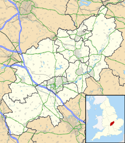
Wellingborough — Coordinates: 52°17′38″N 0°41′47″W … Wikipedia
Buckingham — For other uses, see Buckingham (disambiguation). Coordinates: 51°59′44″N 0°59′12″W / 51.9956°N 0.9868°W / 51.9956; 0.9868 … Wikipedia
Wellingborough (borough) — Infobox UK district name = Borough of Wellingborough status = Borough region = East Midlands admincounty = Northamptonshire area = Ranked 204th 163.04 km² adminhq = Wellingborough onscode = 34UH population = Ranked English district rank|ONS=34UH… … Wikipedia
Wollaston, Northamptonshire — Wollaston is a village in Eastern Northamptonshire, England. The name is derived from the Saxon Wulfaf s Town named after a Saxon chief of that name.In common with the rest of Northamptonshire, Wollaston is noted for its shoe industry. Until 2001 … Wikipedia
List of places in Northamptonshire — This is a list of places in the ceremonial county of Northamptonshire, United Kingdom. See the list of places in England for places in other counties See also compactTOC NOTOC AAbington Abthorpe Achurch Adstone Alderton Aldwincle Althorp… … Wikipedia
Romaldkirk — infobox UK place country = England static static image caption = Romaldkirk village green latitude = 54.59358 longitude = 2.01049 official name = Romaldkirk population = shire district= Teesdale shire county = County Durham region = North East… … Wikipedia
Grendon, Northamptonshire — infobox UK place country = England latitude= 52.2357 longitude= 0.7178 official name= Grendon population = 477 (2001) shire district= Wellingborough shire county = Northamptonshire region= East Midlands constituency westminster= Wellingborough… … Wikipedia
List of civil parishes in Northamptonshire — This is a list of civil parishes in Northamptonshire, England. Most parishes have their own parish council, but some smaller parishes may have a parish meeting, or may join together to form a combined parish council. Some larger parishes have… … Wikipedia
 Strixton
 Reino Unido
 Wikimedia Commons alberga contenido multimedia sobre Strixton. Commons