- Sugarland Run (Virginia)
-
Sugarland Run, Virginia Lugar designado por el censo de los Estados Unidos Ubicación de Sugarland Run en el condado de Loudoun, Virginia.
 Sugarland Run
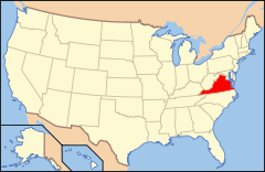
Ubicación de Virginia en EE. UU.Coordenadas: Entidad Lugar designado por el censo • País  Estados Unidos
• Estado  Virginia
• Condado Loudoun Altitud • Media 78[1] msnm Población (2010) • Total 11.799 hab. Código ZIP 20164 Código de área 703 Sugarland Run es un lugar designado por el censo situado en el condado de Loudoun, Virginia (Estados Unidos). Según el censo de 2010 tenía una población de 11.799 habitantes.[2] [3] Forma parte del área metropolitana de Washington D. C.
Demografía
Según el censo de 2010, Sugarland Run tenía una población en la que el 55,5% eran blancos; el 8,4% afroamericanos; el 0,4% eran indios americanos y nativos de Alaska; el 14,8% eran asiáticos; el 0,1% hawaianos y otros isleños del Pacífico; el 16% de otra raza, y el 4,9% a partir de dos o más razas. El 28,8% del total de la población eran hispanos o latinos de cualquier raza.[4]
Referencias
- ↑ «Geographic Names Information System» (en inglés). Servicio Geológico de los Estados Unidos. Consultado el 11 de julio de 2011.
- ↑ «Encuentra un condado» (en inglés). Asociación Nacional de Condados (11 de julio de 2011). Consultado el 11 de julio de 2011.
- ↑ Oficina del Censo de los Estados Unidos (ed.): «U.S. Gazetteer: 2000 and 1990». Consultado el 10/07/2008.
- ↑ «U.S. Gazetteer: Censo de 2010» (en inglés). Oficina del Censo de los Estados Unidos (16 de febrero de 2011). Consultado el 11 de julio de 2011.
Enlaces externos
 Portal:Virginia. Contenido relacionado con Virginia.
Categorías:- Localidades del condado de Loudoun
- Lugares designados por el censo en Virginia


Wikimedia foundation. 2010.