Sweetwater (Idaho)

Sweetwater (Idaho)
Sweetwater
Lugar designado por el censo de los Estados Unidos
Sweetwater
Sweetwater
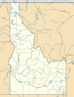
Ubicación en el condado de Nez Perce en Idaho
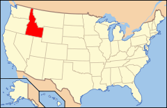
Ubicación de Idaho en EE. UU.
46°22′4″N 116°47′51″O / 46.36778, -116.7975Coordenadas: 46°22′4″N 116°47′51″O / 46.36778, -116.7975
Entidad Lugar designado por el censo
 • País Bandera de los Estados Unidos Estados Unidos
 • Estado Bandera de Idaho Idaho
 • Condado Nez Perce
Superficie  
 • Total 3,08 km²
 • Tierra 3,08 km²
 • Agua (0%) 0 km²
Altitud  
 • Media 334 msnm
Población (2010)  
 • Total 143 hab.
 • Densidad 46,36 hab/km²
Huso horario Pacífico: UTC-8
 • en verano UTC-7
Código de área 208

Sweetwater es un lugar designado por el censo ubicado en el condado de Nez Perce en el estado estadounidense de Idaho. En el Censo de 2010 tenía una población de 143 habitantes y una densidad poblacional de 46,36 personas por km².[1]

Contenido

Geografía

Sweetwater se encuentra ubicado en las coordenadas 46°22′4″N 116°47′51″O / 46.36778, -116.7975. Según la Oficina del Censo de los Estados Unidos, Sweetwater tiene una superficie total de 3.08 km², de la cual 3.08 km² corresponden a tierra firme y (0%) 0 km² es agua.[2]

Demografía

Según el censo de 2010,[3] había 143 personas residiendo en Sweetwater. La densidad de población era de 46,36 hab./km². De los 143 habitantes, Sweetwater estaba compuesto por el 60.84% blancos, el 0% eran afroamericanos, el 37.76% eran amerindios, el 0% eran asiáticos, el 0% eran isleños del Pacífico, el 0% eran de otras razas y el 1.4% pertenecían a dos o más razas. Del total de la población el 2.8% eran hispanos o latinos de cualquier raza.[4]

Referencias

  1. «U.S. Gazetteer: Censo de 2010» (en inglés). Oficina del Censo de los Estados Unidos (16 de febrero de 2011). Consultado el 11 de julio de 2011.
  2. «Encuentra un condado» (en inglés). Asociación Nacional de Condados (11 de julio de 2011). Consultado el 11 de julio de 2011.
  3. «American FactFinder» (en inglés). Oficina del Censo de los Estados Unidos. Consultado el 11 de julio de 2011.
  4. «US Board on Geographic Names» (en inglés). Servicio Geológico de los Estados Unidos (25 de octubre de 2007). Consultado el 11 de julio de 2011.

Enlaces externos


Wikimedia foundation. 2010.

Игры ⚽ Нужно сделать НИР?

Mira otros diccionarios:

  • Sweetwater — may refer to: *Sweetwater (band), a 1960s band *Sweet Water (band), a 1990s band *Sweetwater Brewing Company, of Atlanta, Georgia *Sweetwater Sound, of Fort Wayne, Indiana *Sweetwater (film), a TV filmPlaces in the United States*Sweet Water,… …   Wikipedia

  • Sweetwater — podría referirse a: Lugares Sweet Water (Alabama) Sweetwater (Carolina del Norte) Municipio de Sweetwater (Carolina del Norte) Sweetwater (condado de Duval, Florida) Sweetwater (condado de Hardee, Florida) Sweetwater (condado de Miami Dade,… …   Wikipedia Español

  • Sweetwater — bezeichnet: Sweetwater (Band), eine Band der 1960er Jahre Sweetwater, ein fiktiver Ort im Film Spiel mir das Lied vom Tod Sweetwater ist der Name folgender Orte: Sweet Water (Alabama) Sweetwater (Duval County, Florida) Sweetwater (Hardee County,… …   Deutsch Wikipedia

  • Nez Perce County, Idaho — Seal …   Wikipedia

  • National Register of Historic Places listings in Sweetwater County, Wyoming — Location of Sweetwater County in Wyoming This is a list of the National Register of Historic Places listings in Sweetwater County, Wyoming. This is intended to be a complete list of the properties and districts on the National Register of… …   Wikipedia

  • National Register of Historic Places listings in Nez Perce County, Idaho — Location of Nez Perce County in Idaho This is a list of the National Register of Historic Places listings in Nez Perce County, Idaho. This is intended to be a complete list of the properties and districts on the National Register of Historic… …   Wikipedia

  • Bear Lake (Idaho-Utah) — Infobox lake lake name = Bear Lake image lake = DSCN6179 bearlake e.jpg caption lake = View from Bear Lake State Park in Idaho along its eastern shore image bathymetry = Bathymetry.jpg caption bathymetry = Bathymetric chart location = Idaho/Utah… …   Wikipedia

  • Culdesac, Idaho —   City   Location of Culdesac …   Wikipedia

  • List of places in Idaho/S — This list of current cities, towns, unincorporated communities, counties, and other recognized places in the U.S. state of Idaho also includes information on the number and names of counties in which the place lies, and its lower and upper zip… …   Wikipedia

  • Oregon Trail — For other uses, see Oregon Trail (disambiguation). Oregon Trail The route of the Oregon Trail shown on a map of the western United States from Independence, Missouri (on the eastern end) to Oregon City, Oregon (on the western end) …   Wikipedia

Compartir el artículo y extractos

Link directo
Do a right-click on the link above
and select “Copy Link”