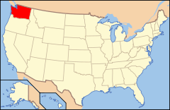
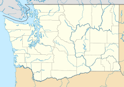
Tahlequah, Washington — Tahlequah is a community on the southern end of Vashon Island in Puget Sound, Washington state. Located at coord|47|19|58|N|122|30|22|W|,GR|3 it is best known for being the north end of the short Point Defiance Tahlequah Washington State Ferries… … Wikipedia
Tahlequah — may refer to: * Tahlequah, Oklahoma * Tahlequah, Washington … Wikipedia
Washington State Route 163 — Infobox WA State Route type=State route=163 sec= parent type=WA parent=16 length mi=3.37 length ref=cite web|author=Washington State Department of Transportation|url=http://www.wsdot.wa.gov/mapsdata/tdo/PDF and ZIP… … Wikipedia
Washington State Ferries — This page is about the ferry system operated by the state of Washington. Other entities operate other Ferries in Washington State Washington State Ferries is a passenger and automobile ferry service owned and operated by the Washington State… … Wikipedia
Washington State Route 339 — Infobox road state=WA type=SR route=339 alternate name=Seattle / Vashon Island PO ferry maint= direction a=West terminus a=jct|state=WA|SR|160|city1=Vashon Heights ferry terminal direction b=East terminus b=jct|state=WA|SR|519|city1=Seattle Pier… … Wikipedia
King County, Washington — For other uses, see King County (disambiguation). King County, Washington Flag … Wikipedia
Tacoma, Washington — Infobox Settlement official name = City of Tacoma settlement type = City nickname = The City of Destiny imagesize = image caption = image mapsize = 250px map caption = Location of Tacoma in Pierce County and Washington State mapsize1 = map… … Wikipedia
Condado de King (Washington) — Para otros usos de este término, véase Condado de King. Condado de King Condados de Washington Mapa … Wikipedia Español
Vashon, Washington — Vashon is a census designated place (CDP) in King County, Washington, United States. It covers an island alternately called Vashon Maury Island or Vashon Island, the largest island in Puget Sound south of Admiralty Inlet. The population was… … Wikipedia
Quartermaster Harbor — is a small harbor located in southern Puget Sound, in Vashon Island, Washington State. Geographic descriptionQuartermaster Harbor is formed by Vashon Island on the west and Maury Island on the east. It opens about convert|0.8|mi|km|sing=on east… … Wikipedia

 Estados Unidos
 Washington
 Portal:Washington. Contenido relacionado con Washington.
 Wikimedia Commons alberga contenido multimedia sobre Tahlequah (Washington). Commons
