Tammenga

Tammenga
Tammenga
Resorts in Paramaribo, Suriname - 20061227.png
Distrito de Paramaribo, con Tammenga en celeste claro
País Bandera de Surinam Surinam
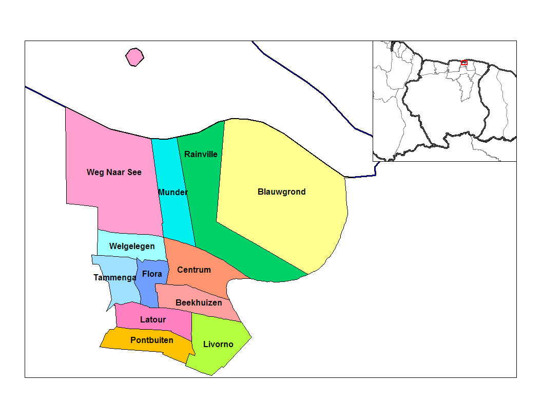
• Distrito Paramaribo
• Suburbio Tammenga
Población 14,313[1] hab. (2004)
Huso horario UTC-3

Tammenga es uno de los doce suburbios, o en neerlandés ressort, en los que se divide el distrito de Paramaribo en Surinam, ubicado al oeste del distrito.

Limita al norte con el suburbio de Welgelegen , al este con el suburbio de Flora, al sur con el suburbio de Latour y al oeste con el distrito de Wanica.

En 2004, Rainville, según cifras de la Oficina Central de Asuntos Civiles tenía 14,313 habitantes.


Referencias

  1. statoids.com. «Datos estadísticos de Tammenga en statoids.com» (en inglés). Consultado el 11 de junio de 2010.

Wikimedia foundation. 2010.

Игры ⚽ Нужно решить контрольную?

Mira otros diccionarios:

  • Paramaribo (distrito) — Saltar a navegación, búsqueda Paramaribo Distrito de Surinam Capital …   Wikipedia Español

  • Districts of Suriname — Suriname This article is part of the series: Politics and government of Suriname Constitution President …   Wikipedia

  • Commewijne District — Map of Suriname showing Commewijne district Commewijne is a district of Suriname, located on the right bank of the Suriname River. Commewijne s capital city is Nieuw Amsterdam. Alliance is another major town. The district has a population of… …   Wikipedia

  • Coronie District — Map of Suriname showing Coronie district Coronie is a district of Suriname, situated on the coast. Coronie s capital city is Totness, with other towns including Corneliskondre, Friendship, Jenny. The district border the Atlantic Ocean to the… …   Wikipedia

  • Marowijne District — Map of Suriname showing Marowijne district Marowijne is a district of Suriname, located on the north east coast. Marowijne s capital city is Albina, with other towns including Moengo and Wanhatti. The district borders the Atlantic Ocean to the… …   Wikipedia

  • Nickerie District — Map of Suriname showing Nickerie district Nickerie is a district of Suriname, on the north west coast. Nickerie s capital city is Nieuw Nickerie, the second largest city in the country. Other towns include Washoda and Wageningen. The district… …   Wikipedia

  • Paramaribo District — Infobox Settlement official name = Paramaribo other name = native name = nickname = settlement type = motto = imagesize = image caption = flag size = image seal size = image shield = shield size = city logo = citylogo size = mapsize = 200px map… …   Wikipedia

  • Saramacca District — Coordinates: 5°46′57″N 55°37′29″W / 5.7825°N 55.62472°W / 5.7825; 55.62472 …   Wikipedia

  • Moengo —   Resort   Map showing the resorts of Marowijne District …   Wikipedia

  • Nieuw Amsterdam, Suriname — Nieuw Amsterdam   Resort and town   …   Wikipedia

Compartir el artículo y extractos

Link directo
Do a right-click on the link above
and select “Copy Link”