- Tanquinho
-
Tanquinho 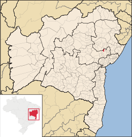
MapaCoordenadas: Coordenadas: Entidad Municipio • País  Brasil
• Estado Bahía • Mesorregión Centro Norte Bahiano • Microrregión Feria de Santana • Fundación 14 de agosto de 1958 Superficie • Total 209,026 km²[1] Altitud • Media 240 msnm Clima semiárido Población (IBGE/2010[2] ) • Total 8.008 hab. • Densidad 38,31 hab/km² Gentilicio tanquinhense PIB (nominal) • Total 22.840,110 mil • PIB per cápita 2912.54 IDH (PNUD/2000[3] ) 0.661 Datos mesorregión IBGE/2008[4] Datos microrregión IBGE/2008[4] Región metropolitana Región Metropolitana de Feria de Santana Municipios vecinos Feira de Santana, Candeal y Santa Bárbara Dist. Cap. 150 Tanquinho es un municipio brasileño del estado de Bahía, localizado en la Región Metropolitana de Feria de Santana. Su población estimada en 2005 era de 7842 habitantes. Está a 146 km del municipio de Salvador y como principal vía de acceso la BR-324, partiendo de Feria de Santana o de Riachão del Jacuípe.
Referencias
- ↑ . Resolução da Presidência do IBGE de n° 5 (R.PR-5/02) (10 out. 2002). Consultado el 5 diez. 2010.
- ↑ . Instituto Brasileiro de Geografia e Estatística (IBGE) (29 de noviembre de 2010). Consultado el 11 de diciembre de 2010.
- ↑ «Ranking decreciente del IDH-M de los municipios del Brasil». Programa das Nações Unidas para o Desenvolvimento (PNUD) (2000). Consultado el 11 de octubre de 2008.
- ↑ a b «División Territorial del Brasil». Instituto Brasileiro de Geografia e Estatística (IBGE) (1 de julio de 2008). Consultado el 11 de octubre de 2008.
- Este artículo fue creado a partir de la traducción automática del artículo Tanquinho de la Wikipedia en portugués, concretamente de esta versión, bajo licencia Creative Commons Atribución Compartir Igual 3.0 y GFDL.
Categoría:- Localidades de Bahía

Wikimedia foundation. 2010.