Tekoa (Washington)

Tekoa (Washington)
Tekoa
Ciudad de los Estados Unidos
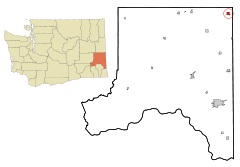
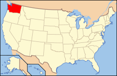
Ubicación en el condado de Whitman en el estado de Washington Ubicación de Washington en EE. UU.
Ubicación en el condado de Whitman en el estado de Washington
Map of USA WA.svg
Ubicación de Washington en EE. UU.
Entidad Ciudad
 • País Bandera de los Estados Unidos Estados Unidos
 • Estado Flag of Washington.svg Washington
 • Condado Whitman
Superficie  
 • Total 2.9 km²
 • Tierra 2.9 km²
 • Agua 0.0 km²
Altitud  
 • Media 772 msnm
Población (2000)  
 • Total 826 hab.
 • Densidad 280,8 hab/km²
Huso horario Pacífico: UTC-8
 • en verano UTC-7
Código ZIP 99033
Código de área 509

Tekoa es una ciudad ubicada en el condado de Whitman en el estado estadounidense de Washington. En el año 2000 tenía una población de 826 habitantes y una densidad poblacional de 280,8 personas por km².[1]

Contenido

Geografía

Tekoa se encuentra ubicada en las coordenadas 47°13′29″N 117°4′25″O / 47.22472, -117.07361Coordenadas: 47°13′29″N 117°4′25″O / 47.22472, -117.07361.[2]

Demografía

Según la Oficina del Censo en 2000 los ingresos medios por hogar en la localidad eran de $30.833, y los ingresos medios por familia eran $36.771. Los hombres tenían unos ingresos medios de $32.014 frente a los $19.307 para las mujeres. La renta per cápita para la localidad era de $14.344. Alrededor del 14,5% de la población estaban por debajo del umbral de pobreza.[3]

Referencias

  1. «Encuentra un condado» (en inglés). Asociación Nacional de Condados (11 de julio de 2011). Consultado el 11 de julio de 2011.
  2. «American FactFinder» (en inglés). Oficina del Censo de los Estados Unidos. Consultado el 11 de julio de 2011.
  3. «U.S. Gazetteer: Censo de 2010» (en inglés). Oficina del Censo de los Estados Unidos (16 de febrero de 2011). Consultado el 11 de julio de 2011.

Enlaces externos


Wikimedia foundation. 2010.

Игры ⚽ Поможем написать курсовую

Mira otros diccionarios:

  • Tekoa, Washington — Infobox Settlement official name = Tekoa, Washington settlement type = City nickname = motto = imagesize = image caption = image imagesize = image caption = image mapsize = 250px map caption = Location of Tekoa, Washington mapsize1 = map caption1 …   Wikipedia

  • Tekoa — may refer to:* Tekoa, Washington, a town in the United States * Tekoa Mountain, a ridge in the Berkshires of Massachusetts, United States * Tuqu , also known as Teqoa, Palestinian town in the West Bank. * Tekoa, Gush Etzion, Israeli settlement in …   Wikipedia

  • Washington locations by per capita income — Washington is the twelfth richest state in the United States of America, with a per capita income of $22,973 (2000) and a personal per capita income of $33,332 (2003).Washington counties ranked by per capita incomeThere are thirty nine counties… …   Wikipedia

  • Washington State Route 27 — infobox WA State Route type=State route=27 sec=115 length mi=90.00 length ref= length round=2 formed=1964 dir1=South dir2=North from= junction= to= in Spokane Valley previous type=State previous route=26 next type=State next route=28State Route… …   Wikipedia

  • Tekoa — Tekoa, WA U.S. city in Washington Population (2000): 826 Housing Units (2000): 363 Land area (2000): 1.135906 sq. miles (2.941982 sq. km) Water area (2000): 0.000000 sq. miles (0.000000 sq. km) Total area (2000): 1.135906 sq. miles (2.941982 sq.… …   StarDict's U.S. Gazetteer Places

  • Tekoa, WA — U.S. city in Washington Population (2000): 826 Housing Units (2000): 363 Land area (2000): 1.135906 sq. miles (2.941982 sq. km) Water area (2000): 0.000000 sq. miles (0.000000 sq. km) Total area (2000): 1.135906 sq. miles (2.941982 sq. km) FIPS… …   StarDict's U.S. Gazetteer Places

  • Washington State Route 274 — Infobox WA State Route type=State route=274 sec=500 parent type=WA parent=27 length mi=1.94 length ref=cite web|author=Washington State Department of Transportation|url=http://www.wsdot.wa.gov/mapsdata/tdo/PDF and ZIP… …   Wikipedia

  • Tekoa — n. Jewish settlement in the Gush Etzion region of the Judean Mountains (Israel); city in Washington state (USA) …   English contemporary dictionary

  • National Register of Historic Places listings in Whitman County, Washington — List of entries on the National Register of Historic Places in Whitman County, Washington, U.S. Contents 1 See also 2 References 3 External links …   Wikipedia

  • List of high schools in Washington — This is a list of high schools in the state of Washington.Adams County*Lind Junior Senior High School, Lind *Othello High School, Othello *Ritzville High School, Ritzville * [http://www.tucna.wednet.edu/default.aspx Washtucna High School,… …   Wikipedia

Compartir el artículo y extractos

Link directo
Do a right-click on the link above
and select “Copy Link”