Underhill (Vermont)

Underhill (Vermont)
Underhill
Pueblo de los Estados Unidos
Underhill
Underhill
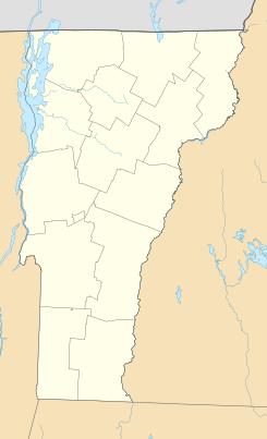
Ubicación en el condado de Chittenden en Vermont
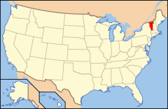
Ubicación de Vermont en EE. UU.
44°32′9″N 72°55′26″O / 44.53583, -72.92389Coordenadas: 44°32′9″N 72°55′26″O / 44.53583, -72.92389
Entidad Pueblo
 • País Bandera de los Estados Unidos Estados Unidos
 • Estado Flag of Vermont.svg Vermont
 • Condado Chittenden
Superficie  
 • Total 133,1 km²
 • Tierra 133,0 km²
 • Agua (0,10%) 0,1 km²
Altitud  
 • Media 315 msnm
Población (2010)  
 • Total 3.016 hab.
 • Densidad 22,66 hab/km²
Huso horario Este: UTC-5
 • en verano UTC-4
Código ZIP 05489
Código de área 802
Sitio web oficial

Underhill es un pueblo ubicado en el condado de Chittenden en el estado estadounidense de Vermont. En el año 2010 tenía una población de 3.016 habitantes y una densidad poblacional de 22,66 personas por km².[1]

Contenido

Geografía

Underhill se encuentra ubicado en las coordenadas 44°32′9″N 72°55′26″O / 44.53583, -72.92389Coordenadas: 44°32′9″N 72°55′26″O / 44.53583, -72.92389.[2]

Demografía

Según la Oficina del Censo en 2000 los ingresos medios por hogar en la localidad eran de $66,492 y los ingresos medios por familia eran $69,837. Los hombres tenían unos ingresos medios de $46,949 frente a los $29,336 para las mujeres. La renta per cápita para la localidad era de $26,746. Alrededor del 5.2% de la población estaban por debajo del umbral de pobreza.[3]

Referencias

  1. «Encuentra un condado» (en inglés). Asociación Nacional de Condados (11 de julio de 2011). Consultado el 11 de julio de 2011.
  2. «U.S. Gazetteer: Censo de 2010» (en inglés). Oficina del Censo de los Estados Unidos (16 de febrero de 2011). Consultado el 11 de julio de 2011.
  3. «American FactFinder» (en inglés). Oficina del Censo de los Estados Unidos. Consultado el 11 de julio de 2011.

Enlaces externos


Wikimedia foundation. 2010.

Игры ⚽ Поможем написать реферат

Mira otros diccionarios:

  • Underhill, Vermont — Infobox Settlement official name = Underhill, Vermont settlement type = Town nickname = motto = imagesize = image caption = image mapsize = 250px map caption = Underhill, Vermont mapsize1 = map caption1 = subdivision type = Country subdivision… …   Wikipedia

  • Underhill — ist der Name folgender Personen: Barbara Underhill (* 1963), kanadische Eiskunstläuferin Eileen Underhill (1899–1998), kanadische Badmintonspielerin Jack Underhill (1902 1974), kanadischer Badmintonspieler John Underhill (1597 1672), Captain in… …   Deutsch Wikipedia

  • Vermont locations by per capita income — Vermont has the twenty fifth highest per capita income in the United States of America, at $20,625 (2000). Its personal per capita income is $30,740 (2003).Vermont counties ranked by per capita incomeThere are fourteen counties located in Vermont …   Wikipedia

  • Vermont Route 15 — Infobox road state=VT type=VT route=15 length mi=68.984 length ref=cite web |url=http://www.aot.state.vt.us/Planning/Documents/TrafResearch/Publications/2006%20Route%20Log%20AADTs%20State%20Highways Final.pdf |title=2006 (Route Log) AADTs State… …   Wikipedia

  • Underhill — Places named Underhill:* Underhill is a town in Vermont, USA.* Underhill is the name given to the area of land at the northern end of the Isle of Portland in Dorset, England, which is very steep and contains the villages of Chiswell, Castletown,… …   Wikipedia

  • Vermont — Pour les articles homonymes, voir Vermont (homonymie). 44° 00′ N 72° 42′ W / …   Wikipédia en Français

  • Jericho (town), Vermont — Jericho is a town in Chittenden County, Vermont, United States. The population was 5,015 at the 2000 census.GeographyAccording to the United States Census Bureau, the town has a total area of 35.5 square miles (91.8 km²), of which, 35.4 square… …   Wikipedia

  • Chittenden-8 Vermont Representative District, 2002–2012 — The Chittenden 8 Representative District is a two member state Representative district in the U.S. state of Vermont. It is one the 108 one or two member districts into which the state was divided by the redistricting and reapportionment plan… …   Wikipedia

  • Historical U.S. Census totals for Chittenden County, Vermont — This article shows U.S. Census totals for Chittenden County, Vermont, broken down by municipality, from 1900 to 2000.Most areas of New England are entirely divided into incorporated municipalities, with no unincorporated territory. In the three… …   Wikipedia

  • National Register of Historic Places listings in Chittenden County, Vermont — Location of Chittenden County in Vermont This is a list of the National Register of Historic Places listings in Chittenden County, Vermont. This is intended to be a complete list of the properties and districts on the National Register of… …   Wikipedia

Compartir el artículo y extractos

Link directo
Do a right-click on the link above
and select “Copy Link”