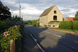
Upper Benefield — is a linear village along the A427 road in the English county of Northamptonshire.It is part of the civil parish of Benefield which, in turn, is part of the district of East Northamptonshire. External links *oscoor gbx|SP978893 … Wikipedia
Benefield — is a civil parish in the East Northamptonshire district of Northamptonshire, England, about six miles east of Corby and three miles west of Oundle. According to the 2001 census it had a population of 308. The parish consists of Upper Benefield… … Wikipedia
Lower Benefield — Pueblo del Reino Unido … Wikipedia Español
List of places in Northamptonshire — This is a list of places in the ceremonial county of Northamptonshire, United Kingdom. See the list of places in England for places in other counties See also compactTOC NOTOC AAbington Abthorpe Achurch Adstone Alderton Aldwincle Althorp… … Wikipedia
A427 road — UK road routebox road= A427 length mi= 20 length km= 32 direction= West East start= Market Harborough destinations= Corby end= Oundle construction date= completion date= junctions= ukroadsmall|6 ukroadsmall|4304 ukroadsmall|6003 ukroadsmall|6014… … Wikipedia
Deenethorpe — Coordinates: 52°30′32″N 0°35′37″W / 52.5090°N 0.5937°W / 52.5090; 0.5937 … Wikipedia
Coventry Council election, 2004 — Elections to Coventry Council were held in June 2004. Due to boundary changes, the entire council was up for election and the council remained with no overall control. After the election, the composition of the council was Conservative 27 Labour… … Wikipedia
Edwards Air Force Base — Part of Air Force Materiel Command (AFMC) Located near: Edwards, California … Wikipedia
List of civil parishes in Northamptonshire — This is a list of civil parishes in Northamptonshire, England. Most parishes have their own parish council, but some smaller parishes may have a parish meeting, or may join together to form a combined parish council. Some larger parishes have… … Wikipedia
Coventry Council election, 2010 — Map of the results of the 2010 Coventry election. Conservatives in blue, Labour in red Elections for Coventry City Council were held on Thursday 6 May 2010. As the council is elected by thirds, one seat in each of the wards was up for election.… … Wikipedia
 Ubicación en Northamptonshire.
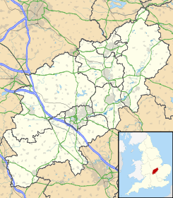
 Upper Benefield
 Reino Unido
 Wikimedia Commons alberga contenido multimedia sobre Upper Benefield. Commons
