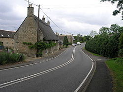
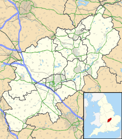
Lower Benefield — is a village on the A427 road in the English county of Northamptonshire.It is part of the civil parish of Benefield which, in turn, is part of the district of East Northamptonshire. External links * [http://www.castleuk.net/castle lists… … Wikipedia
Benefield Castle — was sited in the village of Lower Benefield, between the towns of Corby and Oundle in Northamptonshire at gbmapping|SP987884.Originally the site of a Norman manor house, a stone ringwork fortress was built in the 13th century. It was abandoned by … Wikipedia
Benefield — is a civil parish in the East Northamptonshire district of Northamptonshire, England, about six miles east of Corby and three miles west of Oundle. According to the 2001 census it had a population of 308. The parish consists of Upper Benefield… … Wikipedia
Upper Benefield — Pueblo del Reino Unido … Wikipedia Español
List of places in Northamptonshire — This is a list of places in the ceremonial county of Northamptonshire, United Kingdom. See the list of places in England for places in other counties See also compactTOC NOTOC AAbington Abthorpe Achurch Adstone Alderton Aldwincle Althorp… … Wikipedia
A427 road — UK road routebox road= A427 length mi= 20 length km= 32 direction= West East start= Market Harborough destinations= Corby end= Oundle construction date= completion date= junctions= ukroadsmall|6 ukroadsmall|4304 ukroadsmall|6003 ukroadsmall|6014… … Wikipedia
Sean Bell shooting incident — Memorial to Sean Bell at the place of the shooting The Sean Bell shooting incident took place in the New York City borough of Queens, New York, United States on November 25, 2006, when three men were shot a total of fifty times by a team of both… … Wikipedia
Tax increment financing — Tax Increment Financing, or TIF, is a public financing method which has been used for redevelopment and community improvement projects in the United States for more than 50 years. With federal and state sources for redevelopment generally less… … Wikipedia
Coventry Council election, 2004 — Elections to Coventry Council were held in June 2004. Due to boundary changes, the entire council was up for election and the council remained with no overall control. After the election, the composition of the council was Conservative 27 Labour… … Wikipedia
B-1 Lancer — Infobox Aircraft name = B 1 Lancer type = Strategic bomber national origin = United States manufacturer = North American Rockwell Rockwell International Boeing caption = A B 1B Lancer in flight. designer = first flight = 23 December 1974… … Wikipedia

 Reino Unido
 Wikimedia Commons alberga contenido multimedia sobre Lower Benefield. Commons
