Waitsburg (Washington)

Waitsburg (Washington)
Waitsburg
Ciudad de los Estados Unidos
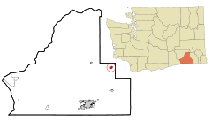
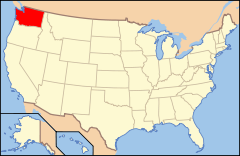
Ubicación en el condado de Walla Walla en el estado de Washington Ubicación de Washington en EE. UU.
Ubicación en el condado de Walla Walla en el estado de Washington
Map of USA WA.svg
Ubicación de Washington en EE. UU.
Entidad Ciudad
 • País Bandera de los Estados Unidos Estados Unidos
 • Estado Flag of Washington.svg Washington
 • Condado Walla Walla
Superficie  
 • Total 2.5 km²
 • Tierra 2.5 km²
 • Agua 0.0 km²
Altitud  
 • Media 385 msnm
Población (2000)  
 • Total 1,212 hab.
 • Densidad 494,0 hab/km²
Huso horario Pacífico: UTC-8
 • en verano UTC-7
Código ZIP 99361
Código de área 509

Waitsburg es una ciudad ubicada en el condado de Walla Walla en el estado estadounidense de Washington. En el año 2000 tenía una población de 1.212 habitantes y una densidad poblacional de 494,0 personas por km².[1]

Contenido

Geografía

Waitsburg se encuentra ubicada en las coordenadas 46°16′5″N 118°9′15″O / 46.26806, -118.15417Coordenadas: 46°16′5″N 118°9′15″O / 46.26806, -118.15417.[2]

Demografía

Según la Oficina del Censo en 2000 los ingresos medios por hogar en la localidad eran de $33.527, y los ingresos medios por familia eran $40.865. Los hombres tenían unos ingresos medios de $31.625 frente a los $21.518 para las mujeres. La renta per cápita para la localidad era de $16.803. Alrededor del 14,0% de la población estaban por debajo del umbral de pobreza.[3]

Referencias

  1. «Encuentra un condado» (en inglés). Asociación Nacional de Condados (11 de julio de 2011). Consultado el 11 de julio de 2011.
  2. «American FactFinder» (en inglés). Oficina del Censo de los Estados Unidos. Consultado el 11 de julio de 2011.
  3. «U.S. Gazetteer: Censo de 2010» (en inglés). Oficina del Censo de los Estados Unidos (16 de febrero de 2011). Consultado el 11 de julio de 2011.

Enlaces externos


Wikimedia foundation. 2010.

Игры ⚽ Поможем решить контрольную работу

Mira otros diccionarios:

  • Waitsburg, Washington — Infobox Settlement official name = Waitsburg, Washington settlement type = City nickname = motto = imagesize = image caption = image imagesize = image caption = image mapsize = 250px map caption = Location of Waitsburg, Washington mapsize1 = map… …   Wikipedia

  • Washington locations by per capita income — Washington is the twelfth richest state in the United States of America, with a per capita income of $22,973 (2000) and a personal per capita income of $33,332 (2003).Washington counties ranked by per capita incomeThere are thirty nine counties… …   Wikipedia

  • Waitsburg — Waitsburg, WA U.S. city in Washington Population (2000): 1212 Housing Units (2000): 522 Land area (2000): 0.947246 sq. miles (2.453356 sq. km) Water area (2000): 0.000000 sq. miles (0.000000 sq. km) Total area (2000): 0.947246 sq. miles (2.453356 …   StarDict's U.S. Gazetteer Places

  • Waitsburg, WA — U.S. city in Washington Population (2000): 1212 Housing Units (2000): 522 Land area (2000): 0.947246 sq. miles (2.453356 sq. km) Water area (2000): 0.000000 sq. miles (0.000000 sq. km) Total area (2000): 0.947246 sq. miles (2.453356 sq. km) FIPS… …   StarDict's U.S. Gazetteer Places

  • Washington State Route 124 — Infobox road state=WA type=SR route=124 alternate name=Ice Harbor Drive maint=WSDOT section=235 map notes=SR 124 highlighted in red length mi=44.68 length round=2 length ref=cite web|author=Washington State Department of… …   Wikipedia

  • Washington State Route 125 — Infobox road state=WA type=SR route=125 maint= map notes=SR 125 highlighted in red length mi=23.65 length round=2 length ref=cite web|author=Washington State Department of Transportation|url=http://www.wsdot.wa.gov/mapsdata/tdo/PDF and ZIP… …   Wikipedia

  • National Register of Historic Places listings in Walla Walla County, Washington — List of entries on the National Register of Historic Places in Walla Walla County, Washington See also National Register of Historic Places listings in Washington This National Park Service list is complete through NPS recent listings posted… …   Wikipedia

  • U.S. Route 12 in Washington — This article is about the section of U.S. Route 12 in Washington. For the entire length of the highway, see U.S. Route 12. U.S. Route 12 US 12 hi …   Wikipedia

  • List of high schools in Washington — This is a list of high schools in the state of Washington.Adams County*Lind Junior Senior High School, Lind *Othello High School, Othello *Ritzville High School, Ritzville * [http://www.tucna.wednet.edu/default.aspx Washtucna High School,… …   Wikipedia

  • City government in the state of Washington — There are 281 municipalities in the U.S. state of Washington. State law determines the various powers its municipalities have. City Classes Legally, a city in Washington can be described primarily by its class. There are five classes of cities in …   Wikipedia

Compartir el artículo y extractos

Link directo
Do a right-click on the link above
and select “Copy Link”