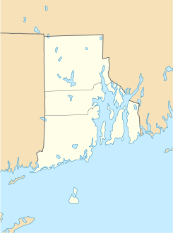
Wakefield (Rhode Island)

Wakefield (Rhode Island)
Wakefield
Villa de los Estados Unidos
Wakefield
Wakefield
Ubicación en el condado de Washington y en el estado de Rhode Island
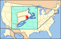
Map of USA RI.svg
Ubicación de Rhode Island en EE. UU.
41°26′15″N 71°30′4″O / 41.4375, -71.50111Coordenadas: 41°26′15″N 71°30′4″O / 41.4375, -71.50111
Entidad Villa
 • País Bandera de los Estados Unidos Estados Unidos
 • Estado Flag of Rhode Island.svg Rhode Island
 • Condado Washington
Huso horario Este: UTC-5
 • en verano UTC-4
Prefijo telefónico 401

Wakefield es una villa ubicada en el pueblo ubicado de South Kingstown en el condado de Washington en el estado estadounidense de Rhode Island. Wakefield es un distrito histórico agregado al Registro Nacional de Lugares Históricos el 30 de mayo de 1996.[1]

Geografía

Wakefield se encuentra ubicado en las coordenadas 41°26′15″N 71°30′4″O / 41.4375, -71.50111Coordenadas: 41°26′15″N 71°30′4″O / 41.4375, -71.50111.[2]

Referencias

Enlaces externos


Wikimedia foundation. 2010.

Игры ⚽ Поможем написать курсовую

Mira otros diccionarios:

  • Rhode Island Conservation Districts — The Road Island Conservation Districts consist of three districts; Northern, Southern and Eastern. They work with the United States Department of Agricultures Natural Resources Conservation Service (NRCS) to deliver technical assistance to the… …   Wikipedia

  • Kingston, Rhode Island — Infobox Settlement official name = Kingston, Rhode Island settlement type = Unincorporated community nickname = motto = imagesize = image caption = image |pushpin pushpin label position =left pushpin map caption =Location within the state of… …   Wikipedia

  • Wakefield-Peacedale, Rhode Island — Infobox Settlement official name = Wakefield Peace Dale, Rhode Island settlement type = CDP nickname = motto = imagesize = image caption = image mapsize = map caption = mapsize1 = map caption1 = subdivision type = Country subdivision name =… …   Wikipedia

  • Rhode Island Route 108 — Infobox RI Route type=RI route=108 length mi=8.6 length round=2 length ref=cite map|publisher=Google Maps|url=http://maps.google.com/maps?hl=en rlz=1T4ADBF enUS232US232 q=from:+Kingstown+Rd/RI 108+%4041.480048,+ 71.520856+to:+Point+Judith+Rd/RI… …   Wikipedia

  • Rhode Island Route 1A — Route 1A is a numbered state highway in Rhode Island, running 34.4 miles in five sections.RouteRoute 1A follows U.S. 1 closely through South County. It can be separated into five sections:*The first section (8.8 miles in length) begins as US 1… …   Wikipedia

  • Southern Rhode Island Conservation District — With offices located in Wakefield, Rhode Island, the Southern Rhode Island Conservation District works with the United States Department of Agriculture s Natural Resources Conservation Service (NRCS) to deliver technical assistance to the people… …   Wikipedia

  • Westerly, Rhode Island —   Town   …   Wikipedia

  • Narragansett, Rhode Island —   Town   …   Wikipedia

  • Charlestown, Rhode Island —   Town   Location of Charlestown in Washington County, Rhode Island …   Wikipedia

  • Matunuck, Rhode Island — Matunuck is a village in South Kingstown, Rhode Island, United States near Charlestown, Rhode Island. The village is located on a point along the southern Atlantic coast of Rhode Island off of U.S. Route 1. The village takes its name from a… …   Wikipedia

Compartir el artículo y extractos

Link directo
Do a right-click on the link above
and select “Copy Link”