Wawayanda

Wawayanda
Wawayanda
Pueblo de los Estados Unidos
Wawayanda
Wawayanda
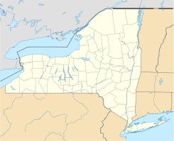
Ubicación en el condado de Orange y en el estado de Nueva York
Map of USA NY.svg
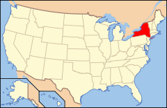
Ubicación de Nueva York en EE. UU.
41°23′36″N 74°27′24″O / 41.39333, -74.45667Coordenadas: 41°23′36″N 74°27′24″O / 41.39333, -74.45667
Entidad Pueblo
 • País Bandera de los Estados Unidos Estados Unidos
 • Estado Flag of New York.svg Nueva York
 • Condado Orange
Superficie  
 • Total 90,7 km²
 • Tierra 90,6 km²
 • Agua (0,14%) 0,1 km²
Altitud  
 • Media 170 msnm
Población (2000)  
 • Total 6.273 hab.
 • Densidad 69.2 hab/km²
Huso horario Este: UTC-5
 • en verano UTC-4
Código postal 10990
Prefijo telefónico 845

Wawayanda es un pueblo ubicado en el condado de Orange en el estado estadounidense de Nueva York. En el año 2000 tenía una población de 6,273 habitantes y una densidad poblacional de 69.2 personas por km².

Contenido

Geografía

Wawayanda se encuentra ubicado en las coordenadas 41°23′36″N 74°27′24″O / 41.39333, -74.45667. Según la Oficina del Censo, la ciudad tiene un área total de 90,7 km² (35 mi²), de la cual 90,6 km² (35 mi²) es tierra y 0,1 km² (0 mi²) (0.14%) es agua.

Demografía

Según la Oficina del Censo en 2000 los ingresos medios por hogar en la localidad eran de $61,885, y los ingresos medios por familia eran $67,479. Los hombres tenían unos ingresos medios de $42,491 frente a los $27,993 para las mujeres. La renta per cápita para la localidad era de $21,856. Alrededor del 3.7% de la población estaban por debajo del umbral de pobreza.[1]

Referencias

  1. «U.S. Gazetteer: Censo de 2010» (en inglés). Oficina del Censo de los Estados Unidos (16 de febrero de 2011). Consultado el 11 de julio de 2011.

Enlaces externos


Wikimedia foundation. 2010.

Игры ⚽ Нужно решить контрольную?

Mira otros diccionarios:

  • Wawayanda — may refer to:*Wawayanda, New York, a town in Orange County, New York *Wawayanda Creek, a creek in Sussex County, New Jersey *Wawayanda State Park, a state park in Sussex County, New Jersey *Wawayanda Patent, an early land grant in the Hudson… …   Wikipedia

  • Wawayanda — ist der Name mehrerer Orte in den Vereinigten Staaten: Wawayanda (New Jersey) Wawayanda (New York) Diese Seite ist eine Begriffsklärung zur Unterscheidung mehrerer mit demselben Wort bezeichneter Begriffe …   Deutsch Wikipedia

  • Wawayanda State Park — is a 16,679 acre (67 km²) state park in Sussex County and Passaic County in northern New Jersey. The park is in Vernon Township on the Sussex side, and West Milford on the Passaic side. There are 60 miles (96 km) of hiking trails in the park,… …   Wikipedia

  • Wawayanda Creek — (pronounced way way yonda ) is the name of Pochuck Creek above its confluence with the tributary Black Creek.Wawayanda Creek/Pochuck Creek is a tributary of the Wallkill River in Sussex County, New Jersey in the United States.It starts northeast… …   Wikipedia

  • Wawayanda Mountain — Infobox Mountain Name = Wawayanda Mountain Photo = Wawayanda Mountain.jpg Caption = Wawayanda Mountain from the Vernon Valley Elevation = 1470 ft Location = New Jersey, USA Range = Appalachian Mountains Prominence = Coordinates =… …   Wikipedia

  • Wawayanda, New York — Infobox Settlement official name = Wawayanda, New York settlement type = Town nickname = motto = imagesize = image caption = image |pushpin pushpin label position = pushpin map caption =Location within the state of New York pushpin mapsize =… …   Wikipedia

  • Parc d'État de Wawayanda — Pays  États Unis État New Jersey Comtés Sussex, Passaic Coordonnées …   Wikipédia en Français

  • Slate Hill, New York — Slate Hill is one of the eight hamlets found in the town of Wawayanda, New York. It is home to the Minisink Valley Central School District. Slate Hill is found in Orange County, New York, one of the fastest growing counties in the state Fact|date …   Wikipedia

  • New Hampton, New York — Central New Hampton, along routes 6 and 17M. New Hampton is a small hamlet in the Town of Wawayanda in Orange County, New York, USA. It is just outside the city of Middletown, across Interstate 84 along US 6 and NY 17M. It has the ZIP Code 10958 …   Wikipedia

  • New York State Route 284 — This article is about the current alignment of NY 284. For the former alignment of NY 284 in Sullivan County, see New York State Route 284 (1931–1939). NYS Route 284 Map of Orange …   Wikipedia

Compartir el artículo y extractos

Link directo
Do a right-click on the link above
and select “Copy Link”