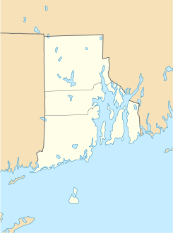
Weekapaug (Rhode Island)

Weekapaug (Rhode Island)
Weekapaug
Lugar designado por el censo de los Estados Unidos
Weekapaug
Weekapaug
Ubicación en el condado de Washington en Rhode Island
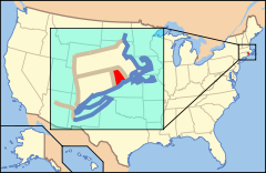
Ubicación de Rhode Island en EE. UU.
41°20′28.01″N 71°45′50.73″O / 41.3411139, -71.7640917Coordenadas: 41°20′28.01″N 71°45′50.73″O / 41.3411139, -71.7640917
Entidad Lugar designado por el censo
 • País Bandera de los Estados Unidos Estados Unidos
 • Estado Flag of Rhode Island.svg Rhode Island
 • Condado Washington
Fundación 21 de junio de 2010
Altitud  
 • Media 10 msnm
Población (2010)  
 • Total 425 hab.
Huso horario Este: UTC-5
 • en verano UTC-4
Código ZIP 02891

Weekapaug es un lugar designado por el censo ubicado en el condado de Washington en el estado estadounidense de Rhode Island. En el año 2010 tenía una población de 425 habitantes.[1]

Geografía

Weekapaug se encuentra ubicado en las coordenadas 41°20′28.01″N 71°45′50.73″O / 41.3411139, -71.7640917Coordenadas: 41°20′28.01″N 71°45′50.73″O / 41.3411139, -71.7640917.[2]

Referencias

  1. «Encuentra un condado» (en inglés). Asociación Nacional de Condados (11 de julio de 2011). Consultado el 11 de julio de 2011.
  2. «American FactFinder» (en inglés). Oficina del Censo de los Estados Unidos. Consultado el 11 de julio de 2011.

Enlaces externos


Wikimedia foundation. 2010.

Игры ⚽ Поможем написать реферат

Mira otros diccionarios:

  • Weekapaug, Rhode Island — Weekapaug is a small fire district in southern Washington County, Rhode Island. It is part of the town of Westerly, Rhode Island, and is a small beachfront community. Weekapaug lies in the Eastern Time Zone and observes daylight saving time.… …   Wikipedia

  • Westerly, Rhode Island —   Town   …   Wikipedia

  • National Register of Historic Places listings in Washington County, Rhode Island — Location of Washington County in Rhode Island This is a list of the National Register of Historic Places listings in Washington County, Rhode Island. This is intended to be a complete list of the properties and districts on the National Register… …   Wikipedia

  • Narragansett Bay — rot umrandet im Verhältnis zu Rhode Island 41.634947 71.363297 Koordinaten …   Deutsch Wikipedia

  • Narragansett Bay — Coordinates: 41°36′N 71°21′W / 41.6°N 71.35°W / 41.6; 71.35 ( …   Wikipedia

  • Misquamicut State Beach — The state beach in August 2010 Misquamicut State Beach is a state park in Westerly Rhode Island. It is a part of Misquamicut Beach which is a seven mile length of beach that stretches from Weekapaug in the east, westward to Watch Hill, which was… …   Wikipedia

  • List of place names in New England of aboriginal origin — This is a List of place names in New England of aboriginal origin. New England is in the northeastern part of the United States, and comprises six states: Connecticut, Maine, Massachusetts, New Hampshire, Rhode Island, and Vermont. Listed are… …   Wikipedia

  • Larchmont (Schiff) — p1 Larchmont p1 Schiffsdaten Flagge Vereinigte Staaten 45 …   Deutsch Wikipedia

  • Westerly — /wes teuhr lee/, n. a town in SW Rhode Island. 18,580. * * * ▪ Rhode Island, United States       town (township), Washington county, southwestern Rhode Island, U.S. It lies along the Pawcatuck River across from Pawcatuck, Connecticut. The state s …   Universalium

  • westerly — westerliness, n. /wes teuhr lee/, adj., adv., n., pl. westerlies. adj. 1. moving, directed, or situated toward the west: the westerly end of the field. 2. (esp. of a wind) coming from the west: a westerly gale. adv. 3. toward the west: to escape… …   Universalium

Compartir el artículo y extractos

Link directo
Do a right-click on the link above
and select “Copy Link”